Skinwalker Ranch: investigating the unknown with PIX4Dmatic
Have you ever looked to the sky and wondered if more could be out there? Perhaps life beyond Earth?
Skinwalker Ranch, located in rural northeastern Utah is known for a high level of strangeness, including UFO sightings and anomalous events. It is currently the site of the hit TV show “The Secret of Skinwalker Ranch.” The show centers on a team using various technologies to investigate why this particular location is so prone to paranormal activity.
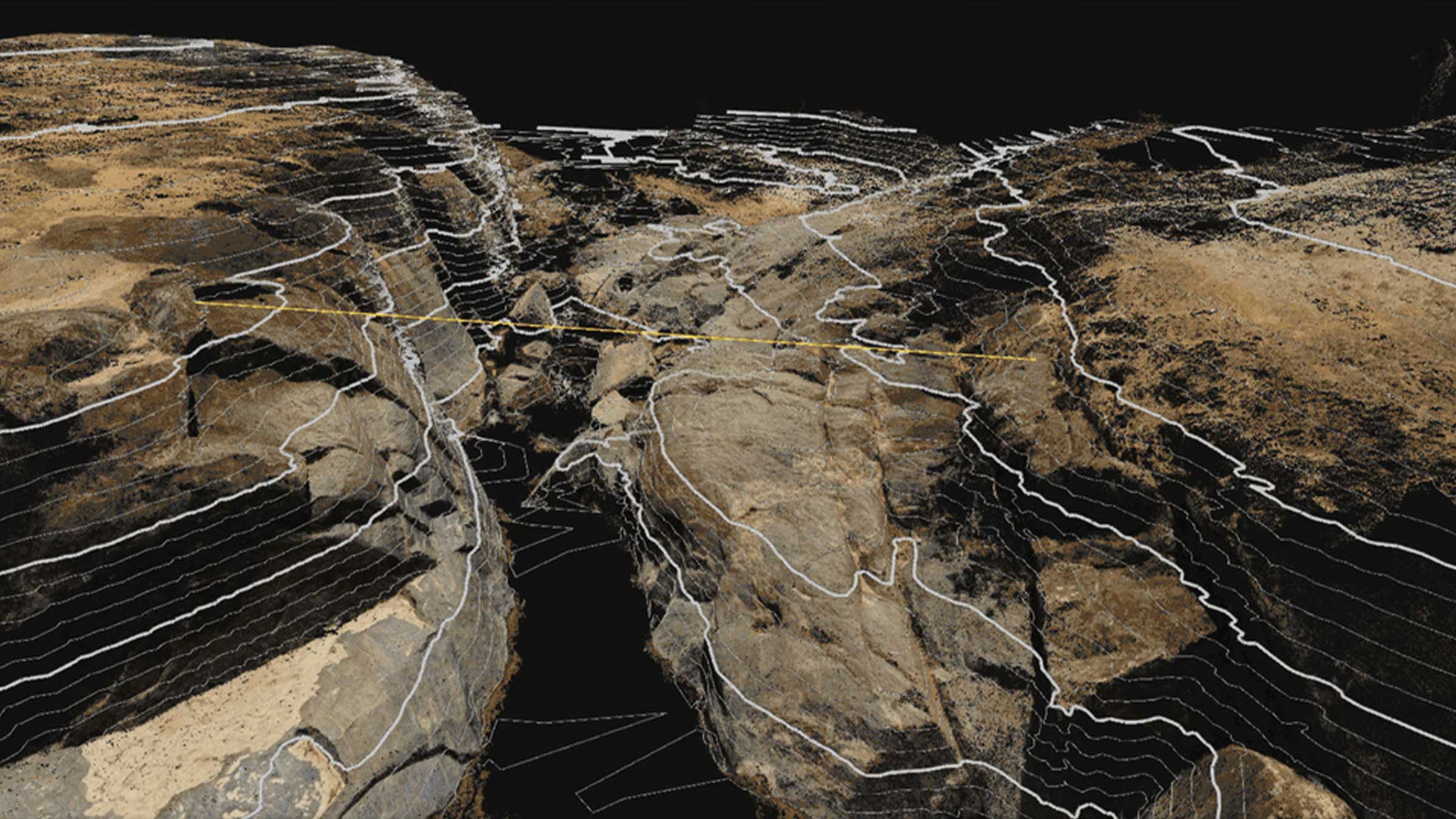
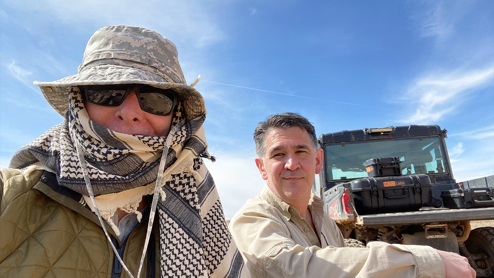
VCTO Labs, based in Washington State and headed by drone mapping expert Pete Kelsey, provides technical solutions to storytellers, filmmakers, and creatives who want to bring stories to life. Pete’s work includes reality capture, civil engineering, and surveying related solutions for film making. Pete and Skinwalker Ranch Principal Investigator, Erik Bard, have recreated the entire 512 acre property in 3D from scratch, as no high-resolution 3D data existed beforehand. Their work is now the standard of truth for the location. The 3D model they have created is survey-grade accurate and was made with PIX4Dmatic.
Project details
| Location | Skinwalker Ranch, Utah, USA |
| User | VCTO Labs |
| Software | PIX4Dmatic |
| Hardware | DJI M300 RTK & P1 |
| Area surveyed | 512 acres |
| Images captured | 32,000 |
| GSD | 1 cm |
Barriers to drone mapping
Pete has faced many challenges with this drone mapping project - not least of which is the bizarre location of Skinwalker Ranch itself. The property has a strange history of electromagnetic interference and anomalies. Electronics often behave erratically there, and GPS can be unpredictable.
Due to these strange factors at play, Pete has lost 3 drones over the past 3 years on the property due to crashes or problems caused by electromagnetic interference.
Mapping Skinwalker Ranch with drones
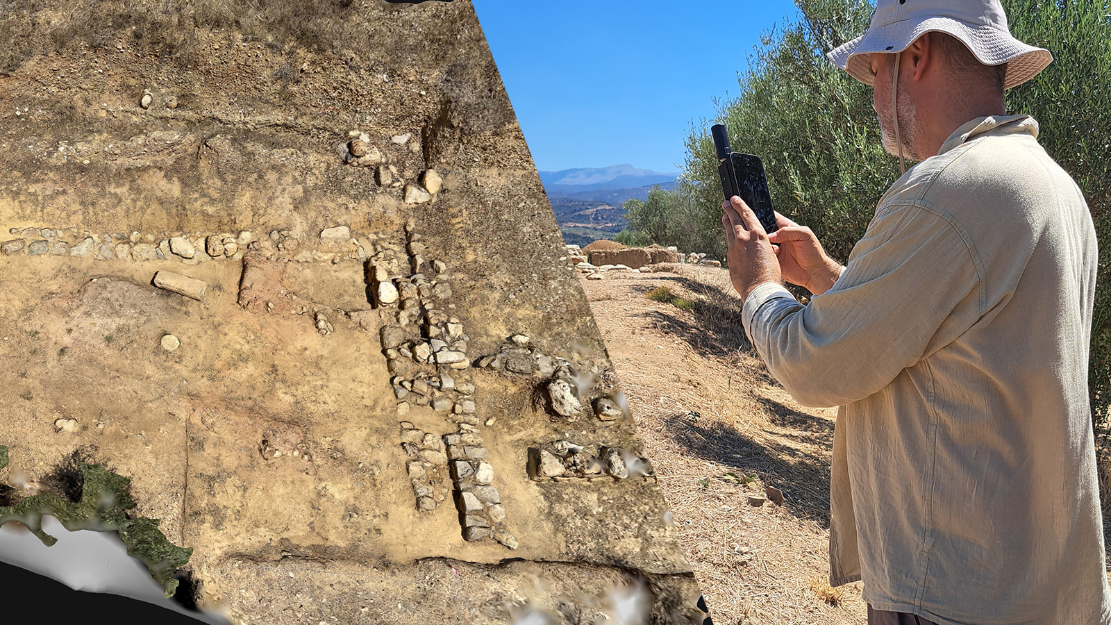
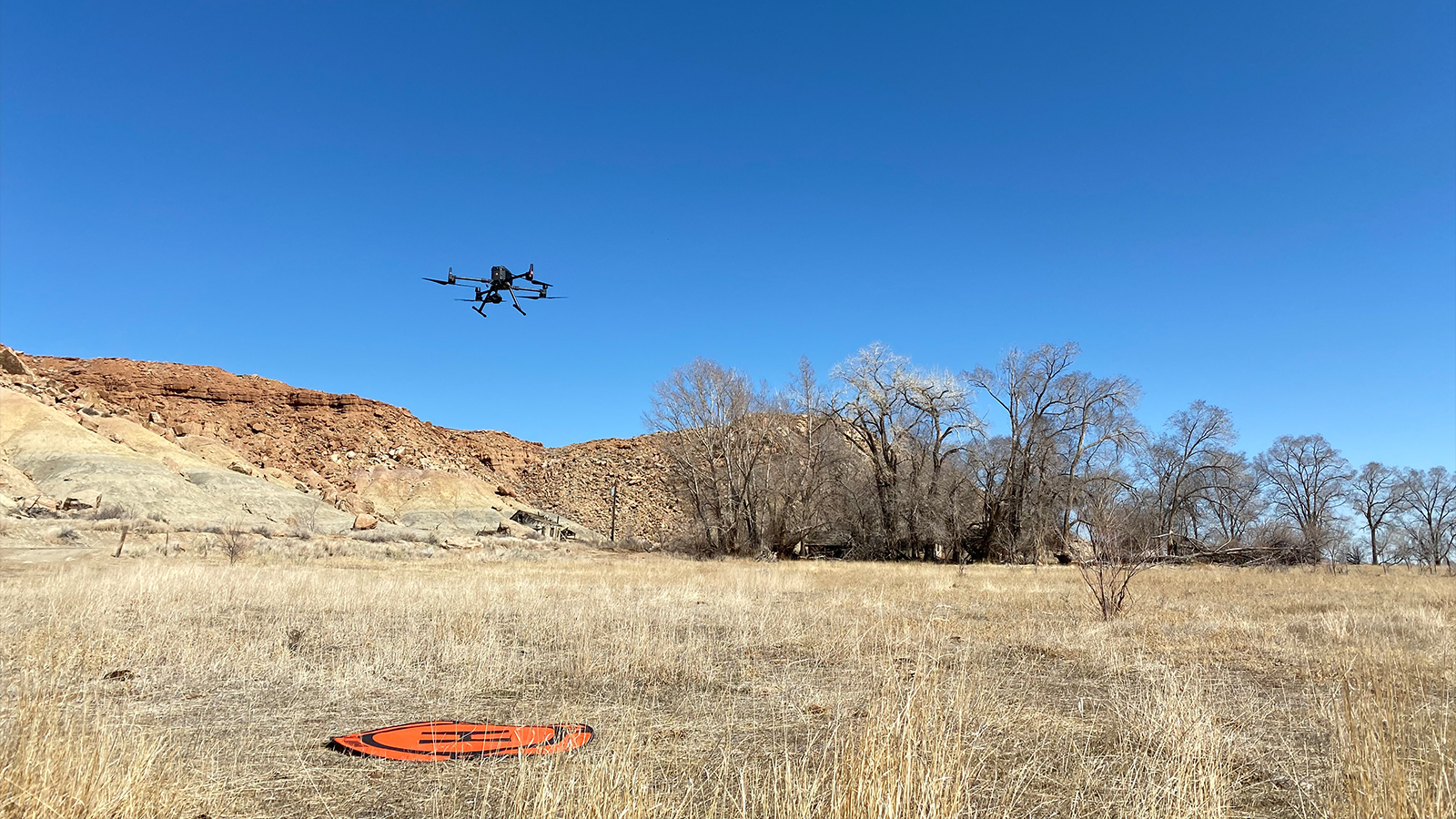
For the latest 3D model, Pete and Erik took 3 days to capture the entire 512 acre property. They set out with Pete’s M300 RTK drone and P1 camera. Because they were using an RTK drone, the geolocation of the final 3D model would be more accurate than without - allowing for minimal interference from strange factors.
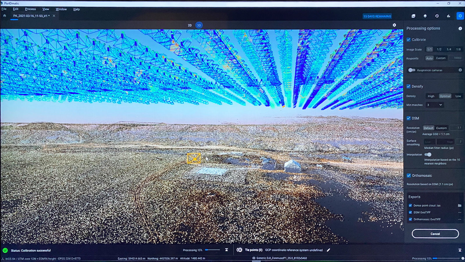
A total of 32,000 images were captured over 7 flights. The data was then imported to PIX4Dmatic to create the 3D model. The results were photorealistic, which is ideal for a TV audience as the model is featured in clips on the TV show as well as planning experiments.
Bringing photogrammetry to the film industry
The results of drone mapping on the site has been used over multiple seasons of “The Secret of Skinwalker Ranch”. Erik Bard is thrilled and fully on board with photogrammetry as a whole and specifically PIX4Dmatic due to its quality of results. Despite no prior experience in drone mapping, Erik picked the software up quickly and was able to use it in hours.
“The data created by PIX4Dmatic at Skinwalker Ranch continues to be the base map that all ongoing research is located to and that subsequent surveys going forward can be measured against. That said it is arguably the most valuable asset related to the ongoing research on the property.” - Pete Kelsey, Owner of VCTO Labs.
Pete Kelsey is a well-known specialist in drone mapping for research and documentaries. His previous work has used Pix4D software to create digital twins of reality including mapping Pearl Harbor to uncover elements of the history that remain. Now, with PIX4Dmatic creating true-to-reality models of Skinwalker Ranch, maybe his team can find out why it is home to so many strange events.