Summit Swagger |
-
Volcán Acatenango (13,041 ft) from Aldea La Soledad Cemetery
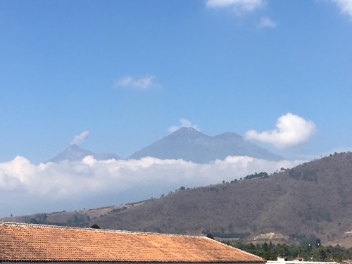
It was our last full day in Guatemala. While the others had already flown back home, Asaka and I still had one more objective; the thirteen thousand foot summit of Volcán Acatenango. We stared at this volcano the past several days in Antigua, captivated by the sister peak of Volcán de Fuego as it continuously belched smoke into the sky. We met Luisa and Don Erick early in the morning outside our hotel once more. We left along the cobblestone streets of Antigua and drove to the northern side of the volcano until reaching a bus stop at Aldea de Soledad next to a cemetery.

The trail left the road and started climbing steeply in between farmlands. The ground was covered with cinders making for a sandy climb. The trench we followed protected us from the morning heat of the sun.

Further to the north was Volcán Santa María.

After several hundred feet of open climbing, we entered a forest. We passed by a wooden structure which sold snacks and drinks. I paused here to relieve myself at the wooden public restroom.

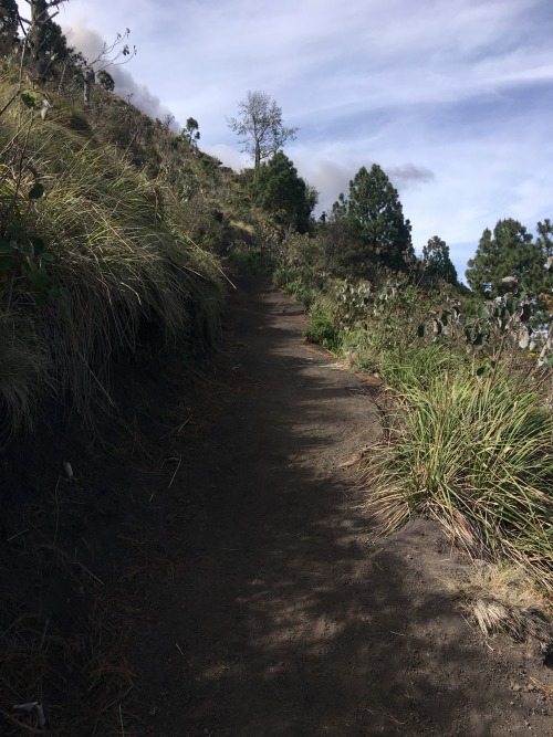
The trail continued steeply up dirt stairs. We took a right at a fork in the trail, but both directions would eventually converge higher up the mountain.

Volcán Tajumulco, the tallest volcano in Central America, became visible north of Volcán Santa María.

As we climbed higher, the forest became more scant. The now sporadic trees made way for more shrubs and grasses.

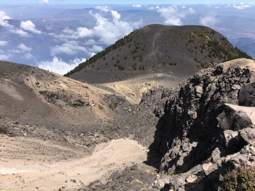
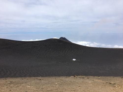
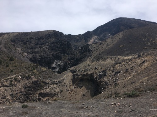
The trail switchbacked to a saddle between Acatenango and the sub peak of Yepocapa. The saddle was desolate and devoid of vegetation.


At the saddle there was an old crater. The weather here was windy and misty, disparate to the climate at the lower elevations of the peak. We took a quick break here and met some stray dogs, which my Salvadorian family calls aguacateros. The poor dogs looked very hungry and thirsty, so we gave them some extra food. Happy to find such caring visitors, they joined us on the final climb, hoping we would give them further provisions.

We followed the main trail as it continued up the left side of the crater. There was another use trail on the right side of the crater but it looked steeper and more difficult. As we climbed, we gave each of the dogs nicknames. I named my favorite dog Cholco, as it was missing his front tooth and had a nervous twitch.

Volcán de Agua stood in solidarity to the south.
The summit was now visible up ahead. Luisa, Asaka, the dogs and I continued our breezy march.

Down below was the sub peak of Yepocapa.
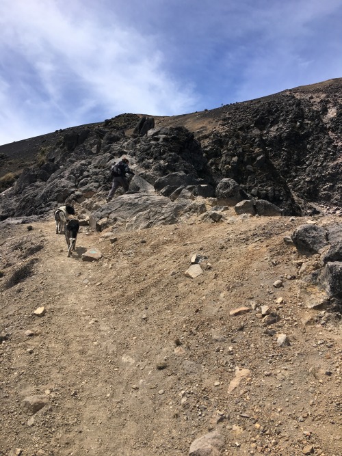
Just below the summit was an incredibly loose and steep section. This was the perfect example of two steps up, one step down. We inched our way up this section, passing some local hikers along the way.
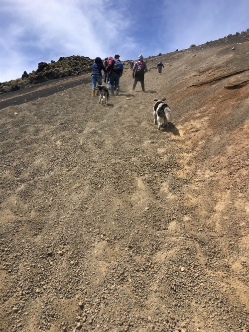
Atop the endurance crux, all that remained was a short walk to the high point.
To the north was Volcán Santa María and Volcán Tajumulco.

To the east was Yepocapa.

To the south was Volcán de Agua.

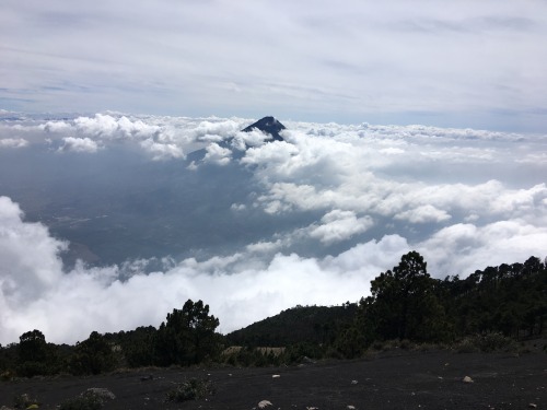
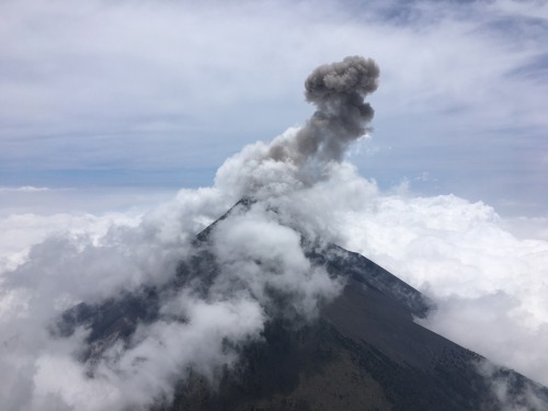
To the west was Volcán de Fuego, which translates to Volcano of Fire.
Luisa and I walked towards the eastern crater rim to eat lunch with a better view of Volcán de Fuego, while the lonely intrepid wanderers Asaka and Cholco sat by themselves on the northern rim.

As I circumvented the crater rim, I heard a distant explosion as Fuego began erupting, throwing rocks and ash into the sky.
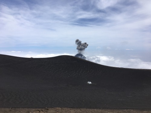
I was astounded by the power of the blast. It was too bright to see the red glow of the molten rocks, but I could see the dust from the rubble slamming against the lower slopes of the volcano.
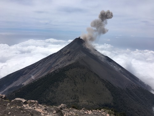
Previously I had wondered if it was possible to climb the active volcano, but I now had my answer. A popular trek is for people to hike to the saddle and watch the eruptions at night. After being awed and distracted by the multiple eruptions, I turned around to look for Asaka and she was nowhere to be found.

I frantically circled the summit crater looking for her. I found her sitting out of sight, inconsiderately oblivious to the concern of her fiance and guide. Afterwards, we ate lunch watching Fuego erupt some more. The clouds continued to grow around us and the nearby volcanoes, so after we got our fill, we continued back down the volcanic slopes, this time taking the use trail on the opposite side of the northern crater adjacent to the saddle between Acatenango and Yepocapa.

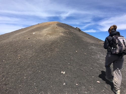
Once at the saddle, I left Asaka and Luisa to climb Yepocapa. I made it to the top in about ten minutes, but the views were mostly obstructed by clouds. I had to wait for the clouds to clear to get a good photo of Acatenango.

On our descent we took the alternate fork, which seemed equally steep and long. The dirt steps allowed us to descend at a brisk pace. The fertile volcanic soil allowed beautiful wildflowers to grow.


By the time we reached the farmlands the mountain was soaked in fog. The last part of the sandy trail made for easy walking. We met Don Erick at the trailhead and he drove us back to our hotel in Antigua. The hike was about 8 miles round trip and required about 5,200 ft of elevation gain.

The next morning Don Erick drove us to the airport in Guatemala City and we flew back to the States. All our mountaineering objectives were achieved on the trip.