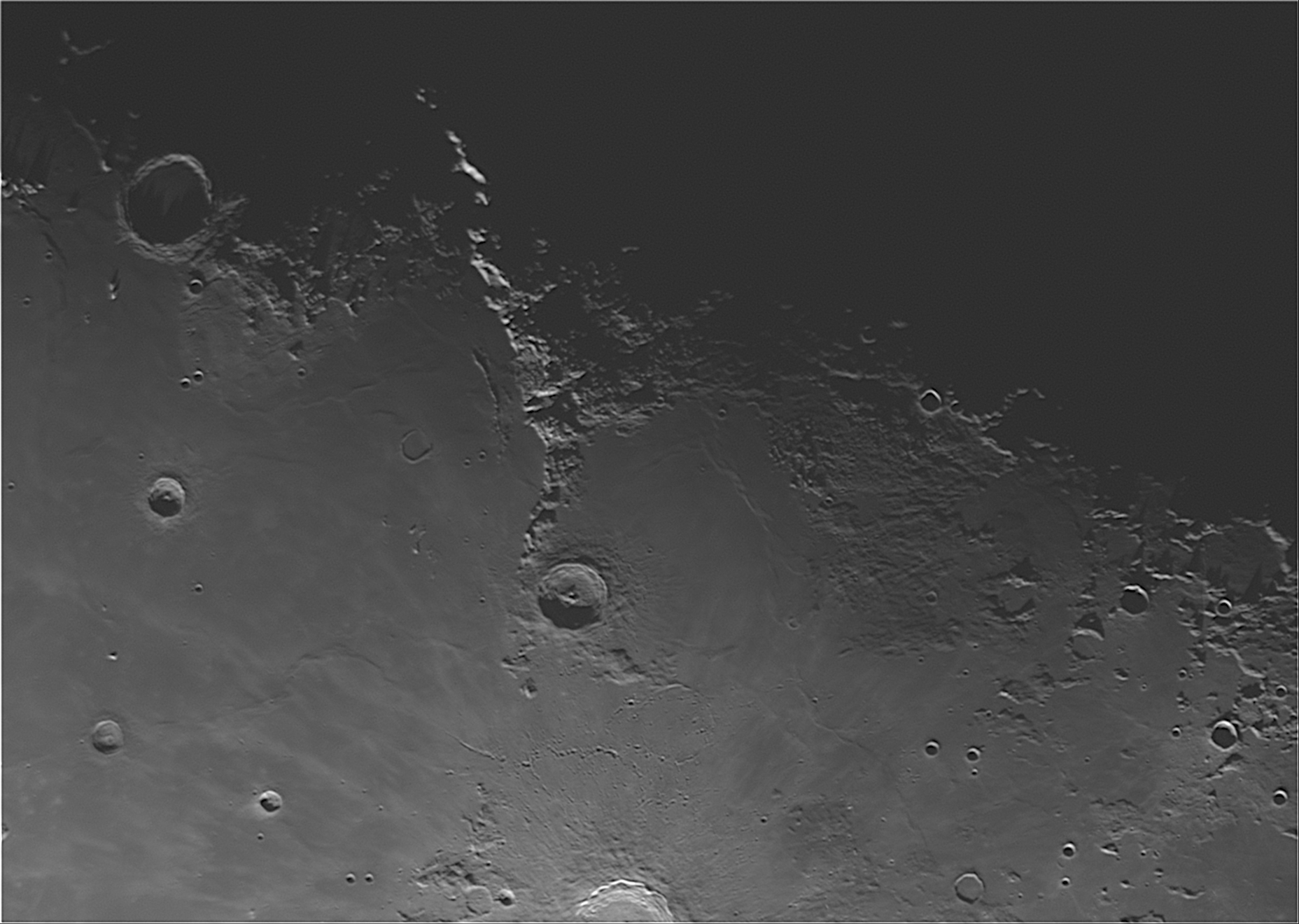
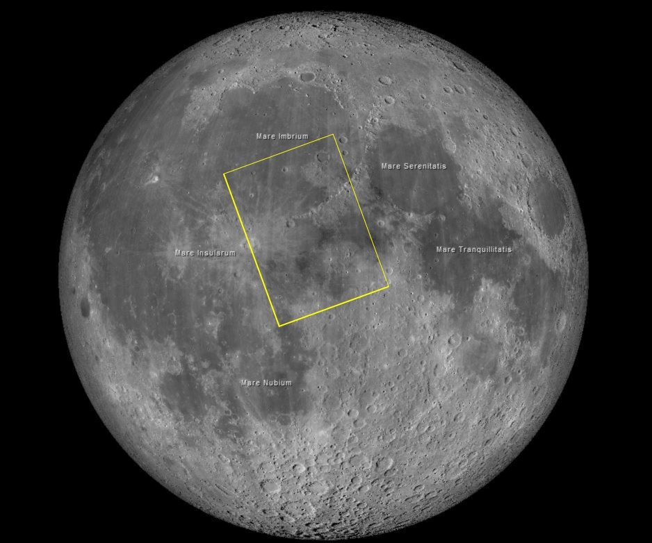
I am still concentrating on planetary/lunar imaging while my deep space camera is getting an improved power supply. The curving mountain range defines the eastern edge of the large impact basin, Mare Imbrium, thought to have been formed when a large object impacted the Moon during the late heavy bombardment era (4.1-3.8 billion years ago).
Exposure Data [(V)L:240×6.9msec]
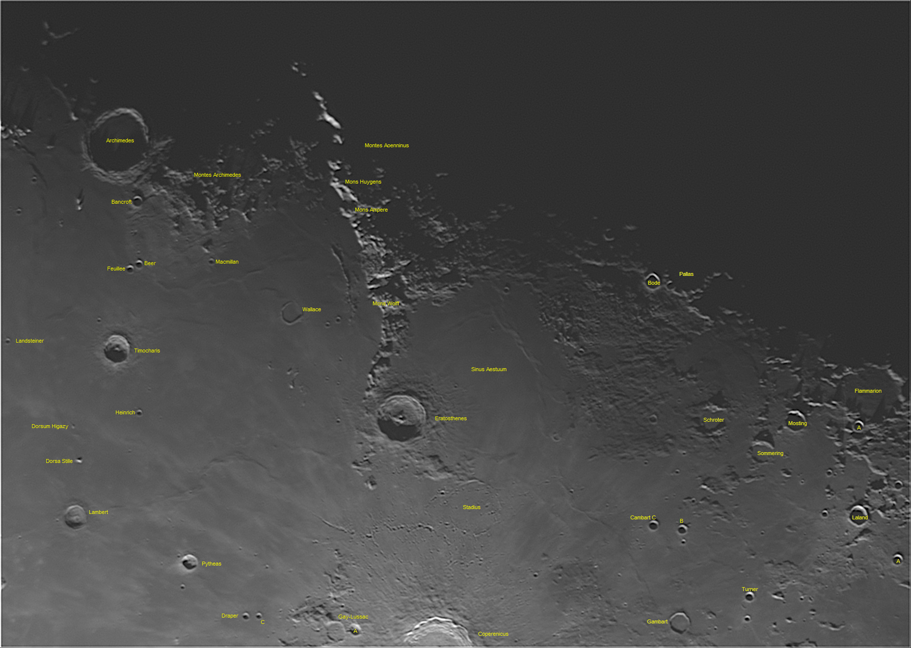
The flat area right of Mare Imbrium is Sinus Aestuum (Seething Bay), another lava filled plain considered a part of Mare Insularum (Sea of Islands). The image below is the same image but annotated to identify the geological elements.
|
 Map generated with Virtual Moon Atlas |
The large central crater is Eratosthenes. It was estimated to have formed 3.2 billion years ago and is 35 miles across and 2.25 miles deep. It is named after the Greek astronomer Eratosthenes of Cyrene (≈276-174 BC), considered the father of geography. He was chief librarian at the library of Alexandria, and is credited with estimating the Earth’s circumference and the tilt of Earth’s axis of rotation, both with surprising accuracy. He also invented the concept of the leap day.