Cacciatore Loop
Fósne – Camillo Depaoli – Rifugio Velo della Madonna – Cacciatore
gian • 19/07/2019
Details
- Sport
- Hike
- Rating
- Difficulty
- Demanding
- Duration
- 06:00 hrs
- Length
- 13.0 km
- Vertigo
- Medium
- Min. elevation
- 1340 m
- Max. elevation
- 2473 m
- Elevation gain
- 1400 m
- Elevation loss
- 1400 m
- Car park
- View on Gmaps
Terrain
- 45%
- 5%
- 50%
- Forest
- Grass
- Rock
Seasons
- Jan
- Feb
- Mar
- Apr
- May
- Jun
- Jul
- Aug
- Sep
- Oct
- Nov
- Dec
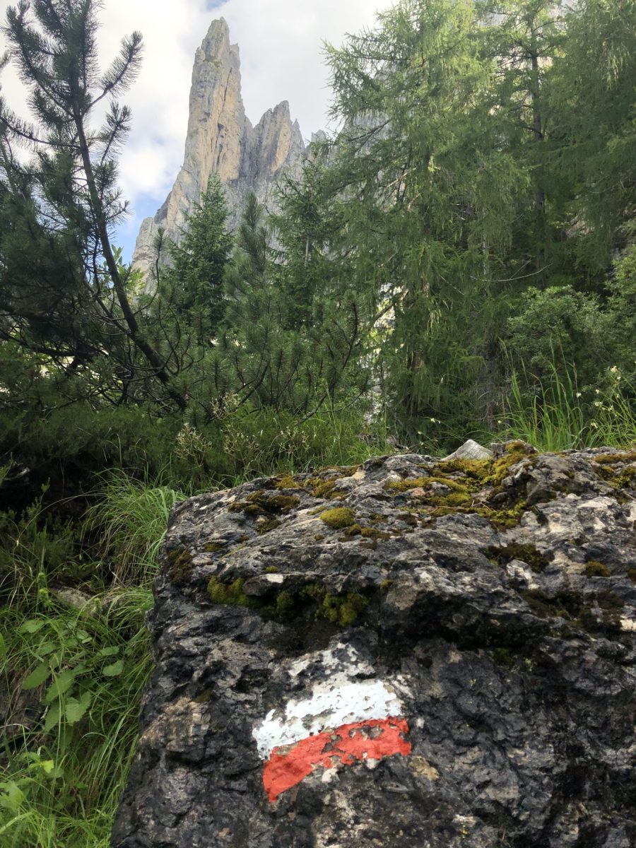
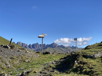
Signposts
Description
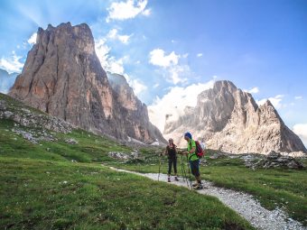
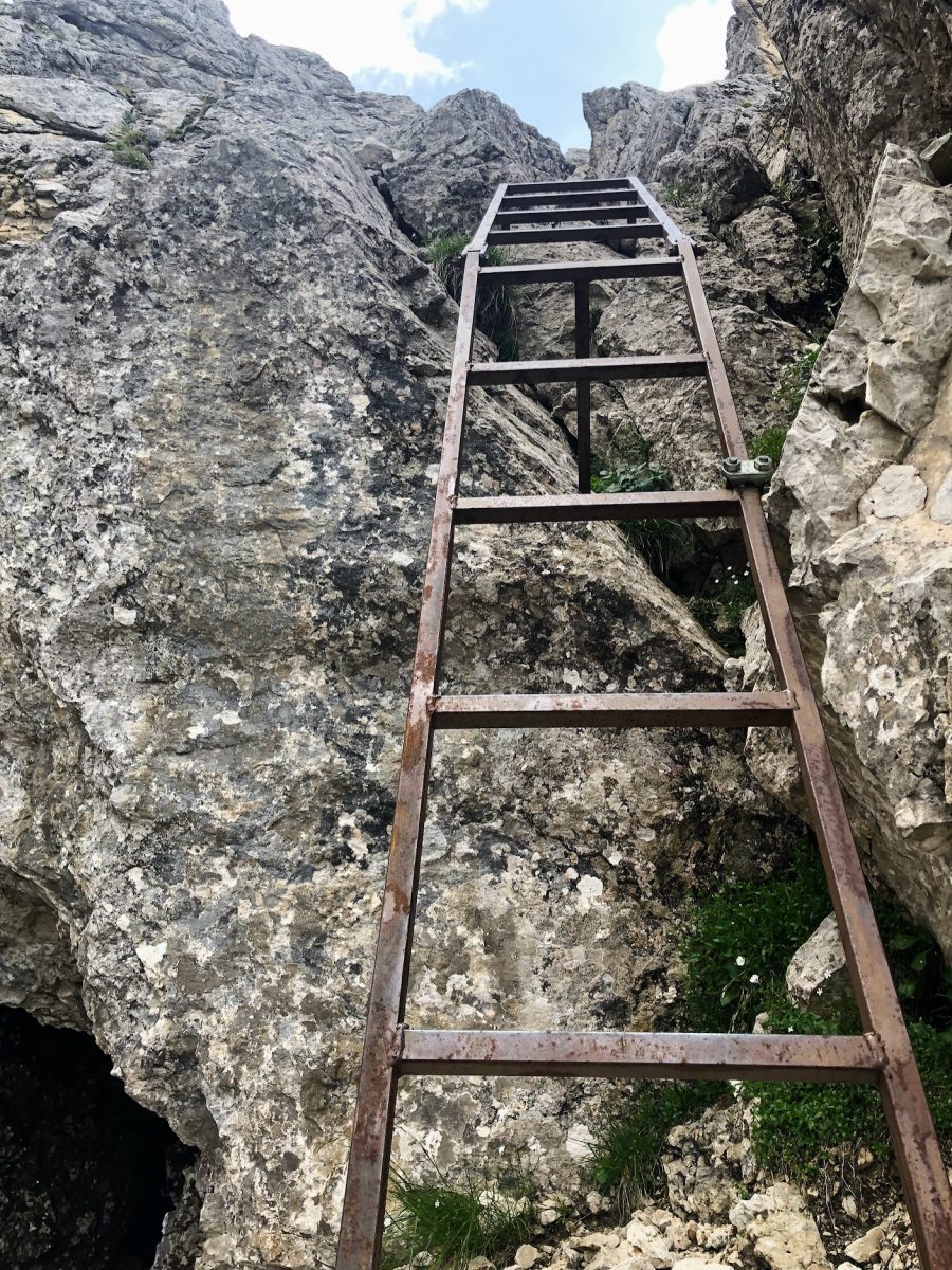
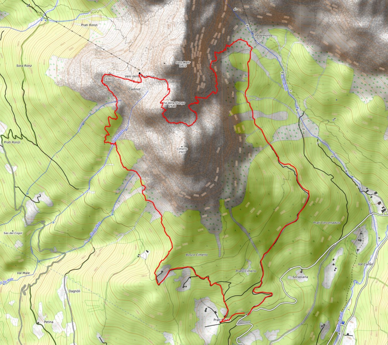
Perhaps, it is not enough to state that this is a classic route on the Dolomites of the Pala Group. This trek, looping around the Sass Maór subgroup of the Pale di San Martino, is certainly one of the most popular routes among expert hikers. The paths on which the trek develops are all falling into the category EEA (tr. for expert hikers with equipment). Although these are not proper Via Ferrata, that indicates that in many places on the paths there is the presence of fixed ropes and stairs. Thus, this hike is definitely not recommended if you are not feeling comfortable with this kind of experience.
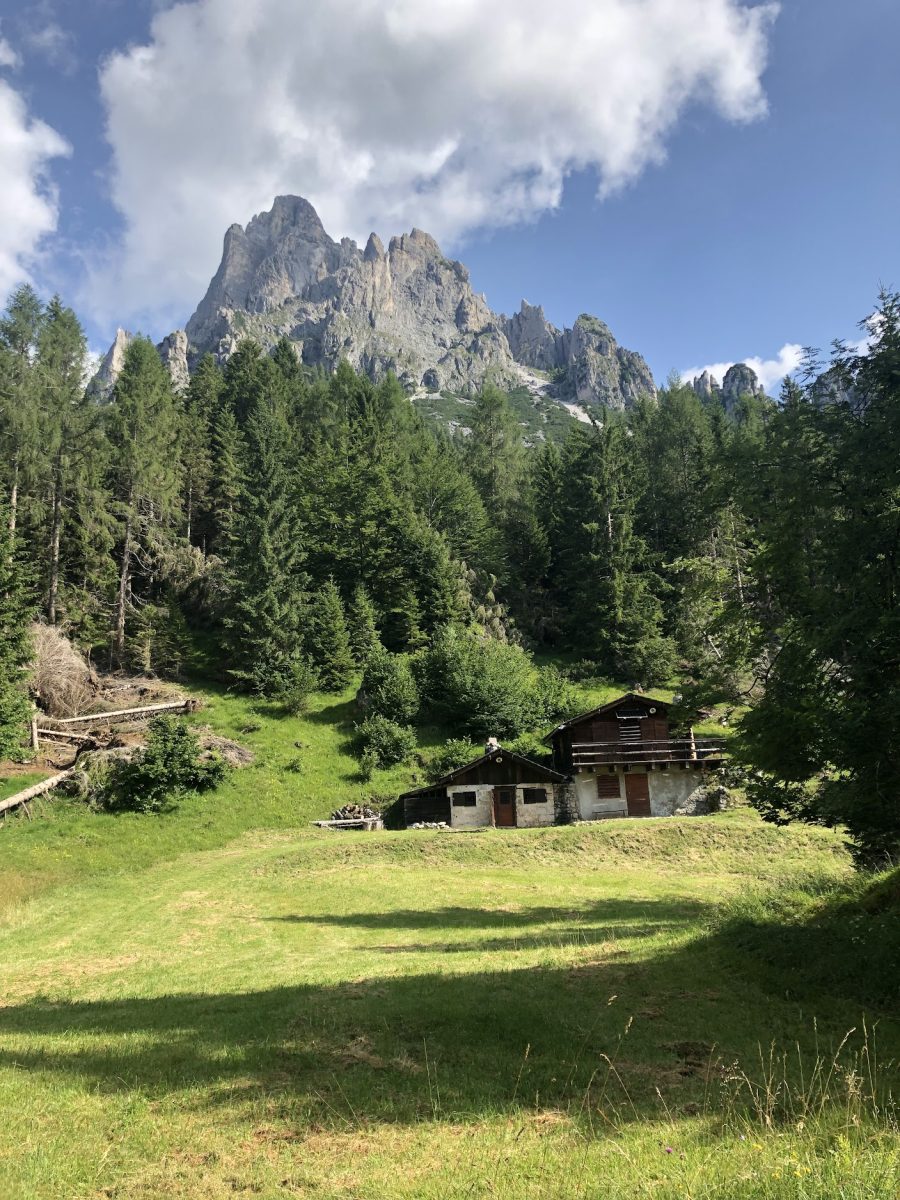
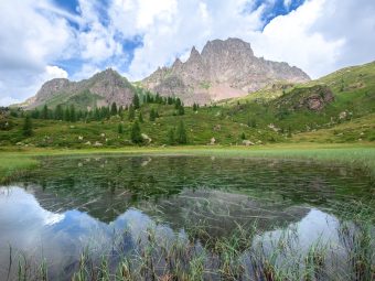
The hike starts from Fósne (approx. 1,500 m asl), located just above the tourist resort of Pieréni, in Canáli Valley. The mix of landscape with pastures and the group of mountain huts around a boulder characterizes the location of Fósne as one of the most picturesque places of Primiero. The first part of the route follows the Signpost No. 731, connecting Fósne to Còl dei Cístri. This stretch of the route is entirely in the forest and constantly surrounded by a beautiful landscape revealing the Cimèrlo peak (2,504m asl) to the N and the Primiero Valley to the S.
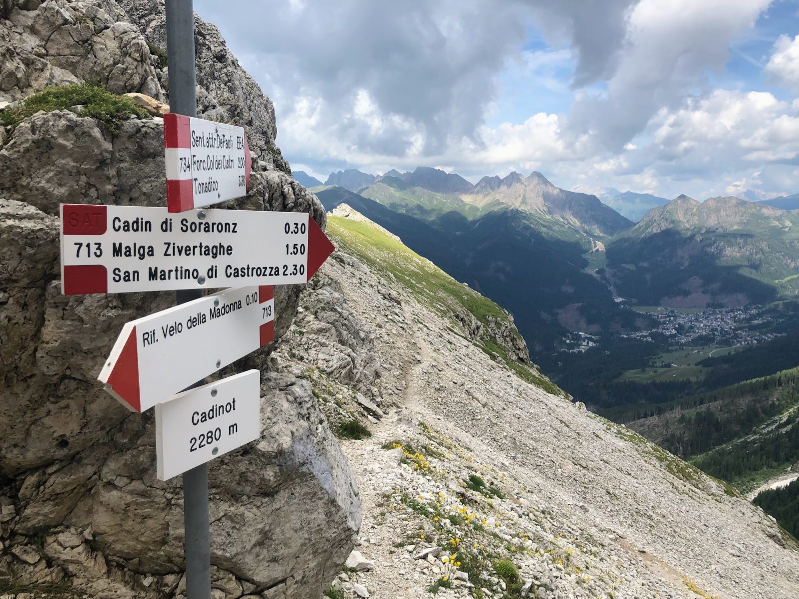
Once reaching Forcella Col dei Cistri gap (1,568 m asl, not according to the signs, but according to the LIDAR), take the Signpost No. 734A, also known as Sentiero Camillo Depaoli and proceed towards Rifugio Velo della Madonna.
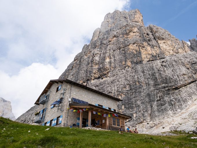
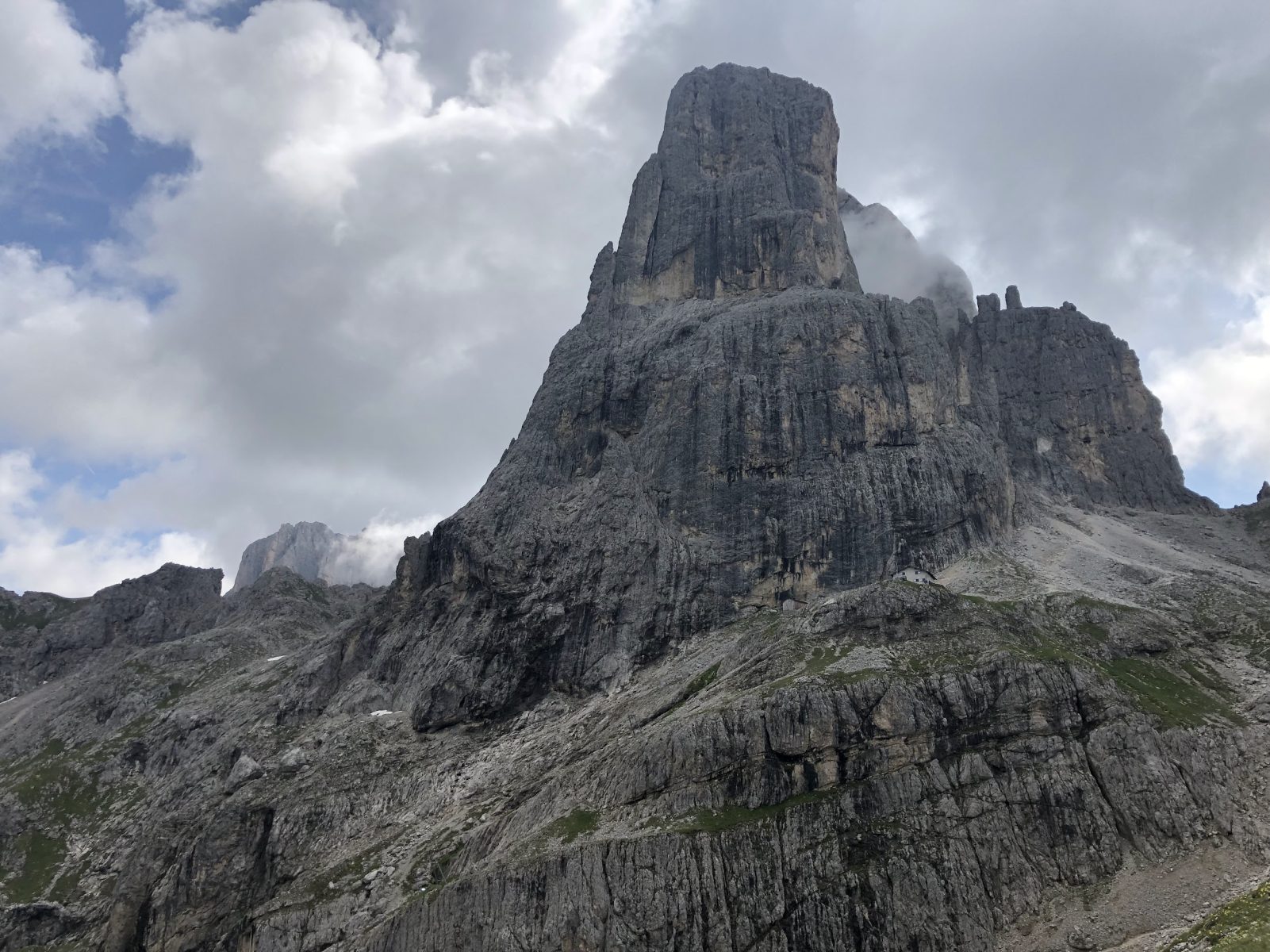
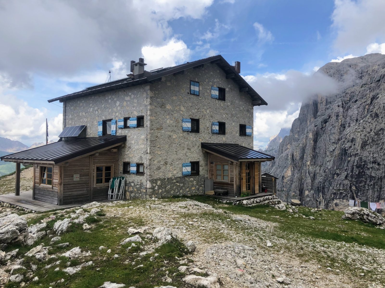
After about two kilometers of gentle ascend along the slope, the Sentiero Camillo Depaoli path begins to climb for real, leading directly to the Cadinòt (2,280 m asl), a wide valley that precedes the Rifugio Velo della Madonna (2,358 m asl).
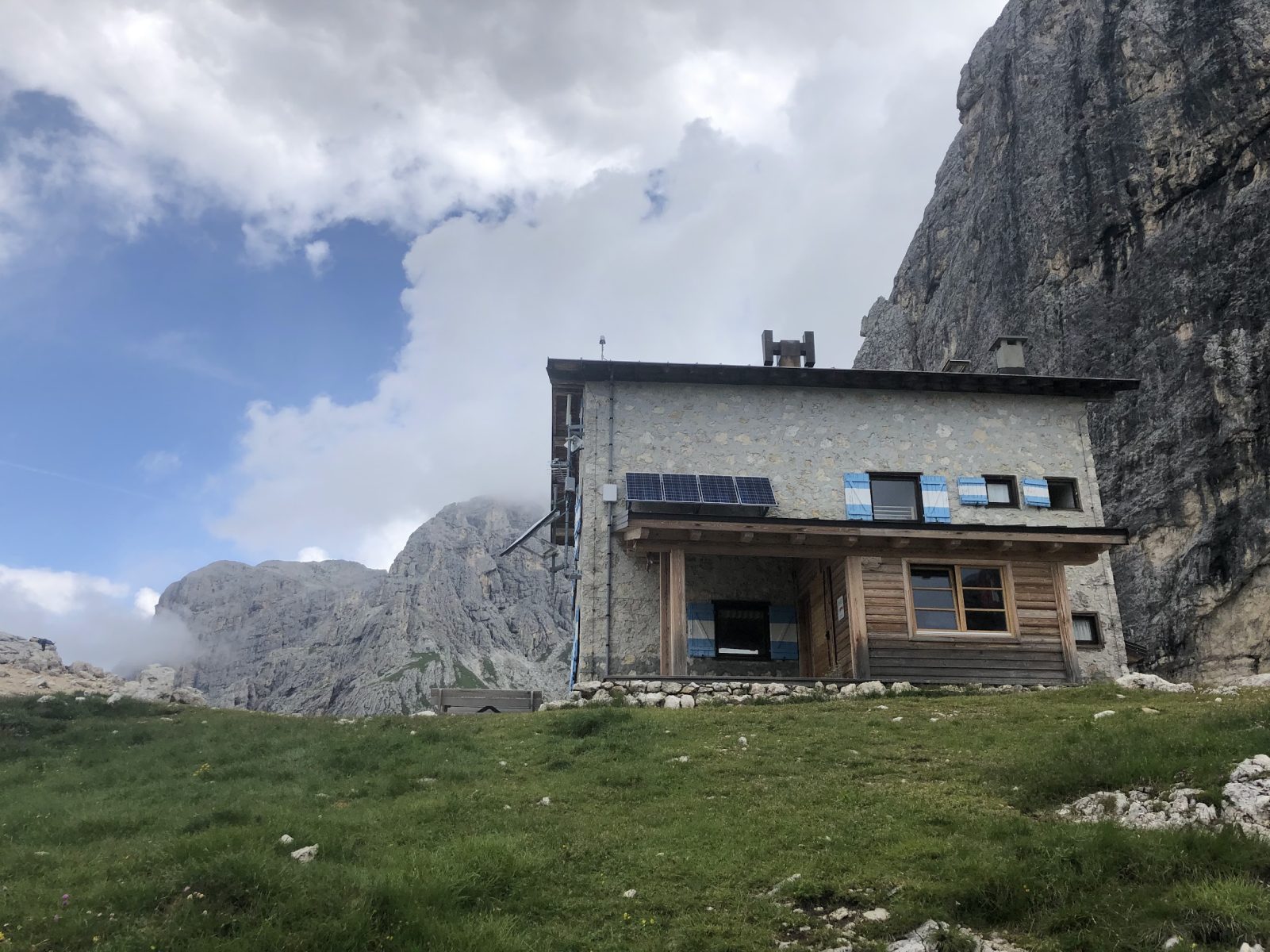
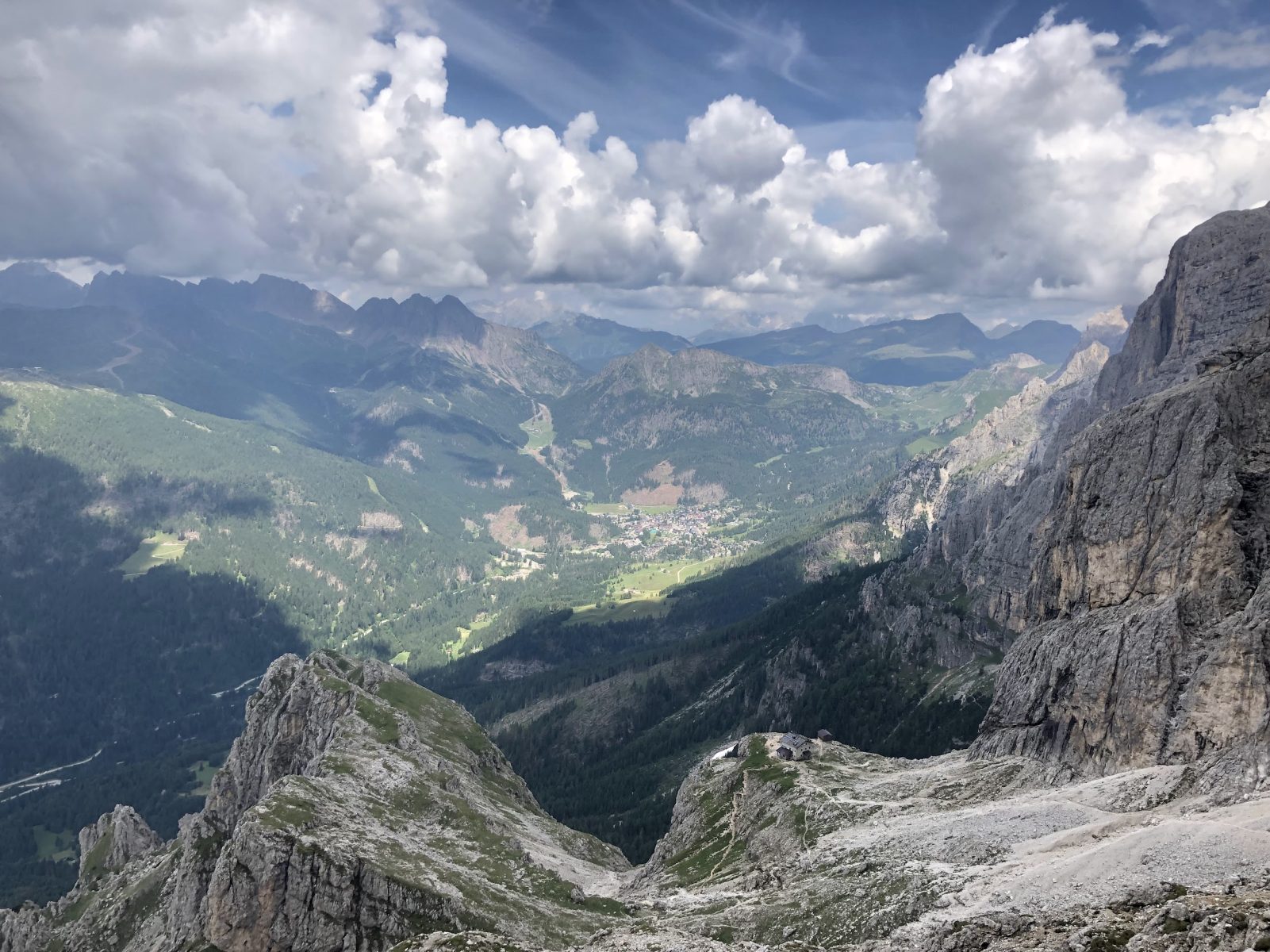
Once you arrive at the hut, we advise you to take a break allowing you to take a look at the landscape (simply amazing). In addition to the peaks of Madonna, Val di Ròda, Ball and Stanga, from the hut it is possible to have a complete overview over the village of San Martino di Castrozza and the mountain range of Lagorai. The hut is a crossroads for numerous treks and starting point of some important climbing routes, on which the classic “Via dello Spigolo del Velo” stands out.
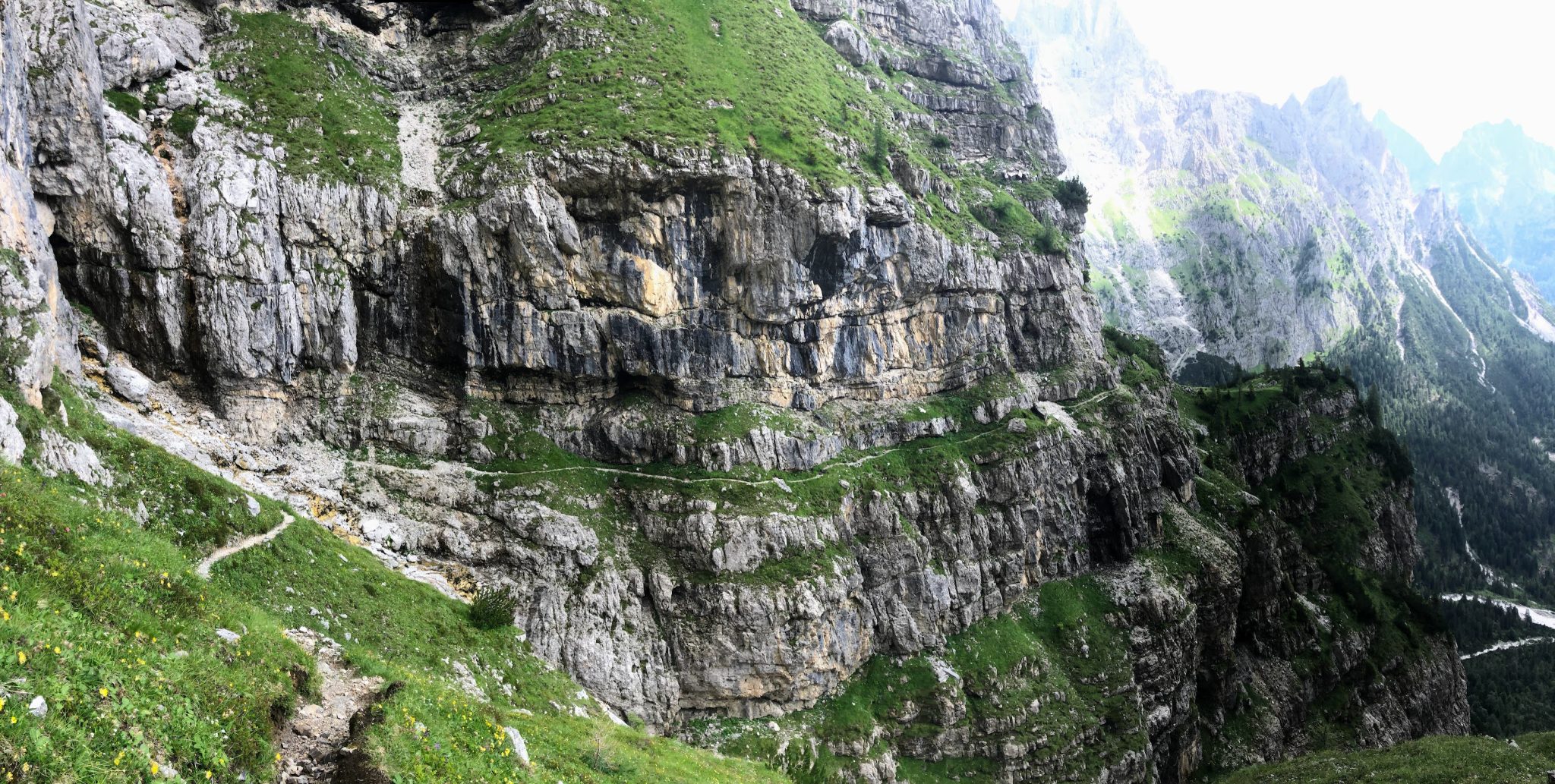
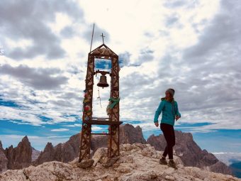
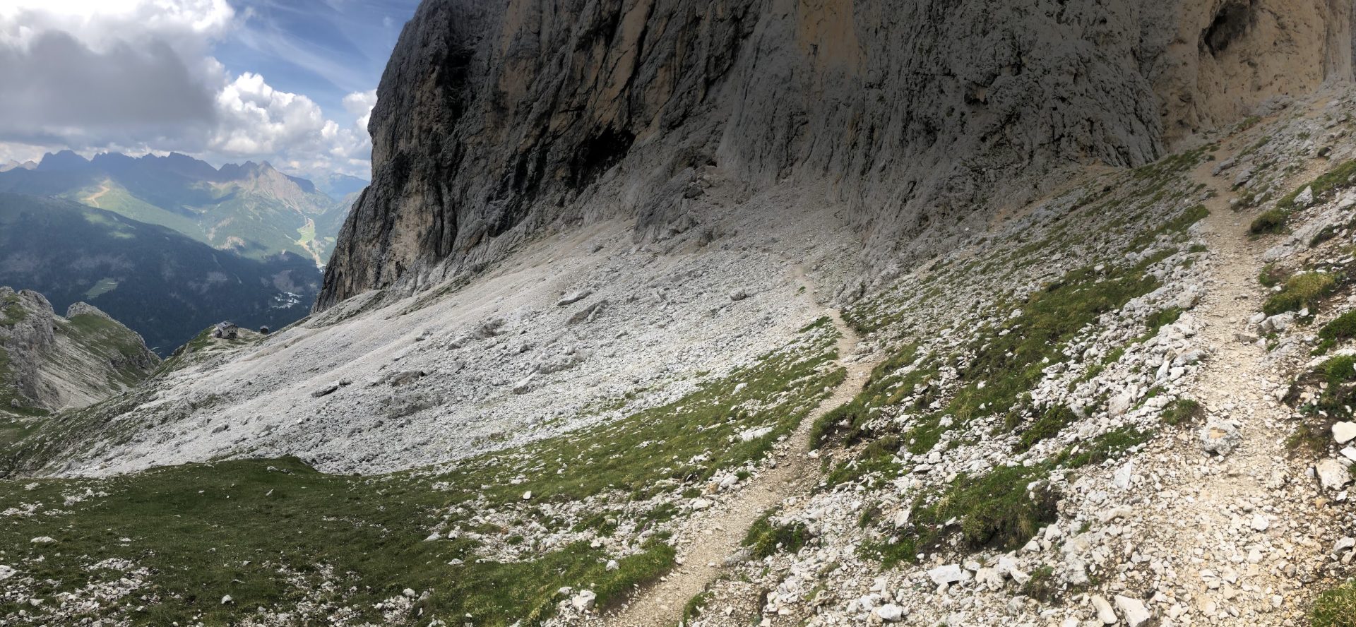
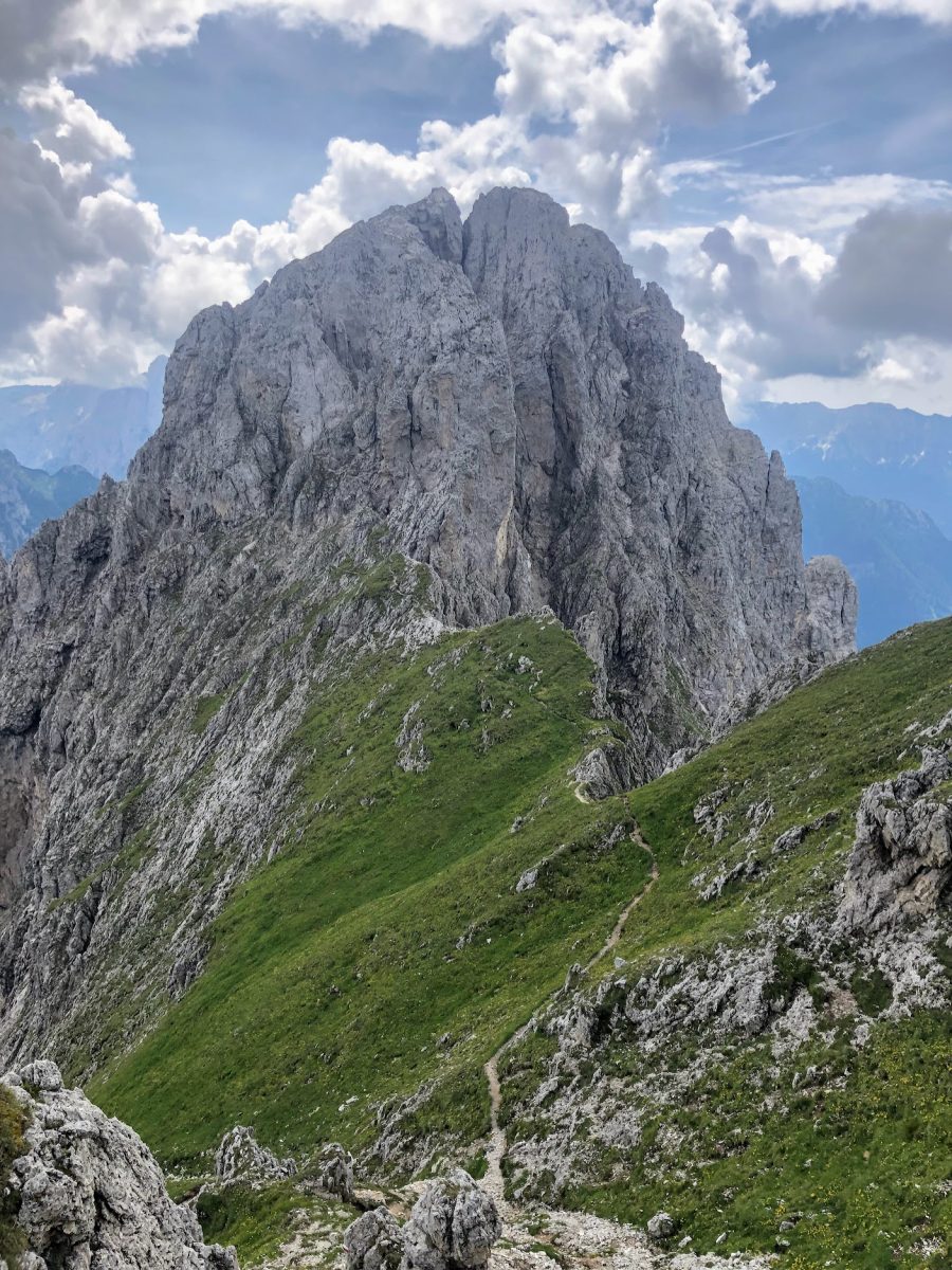
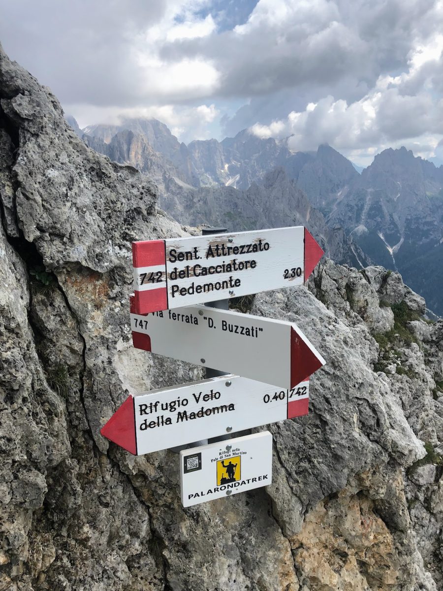
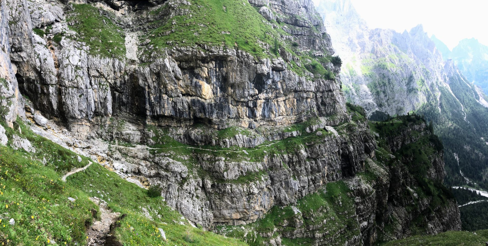
From Rifugio Velo della Madonna, the hike continues on the Signpost No. 742 towards the Sentiero del Cacciatore (tr. trail of the hunter) / Ferrata Dino Buzzati. The climb will take you in less than a kilometer on the southern side of the Stanga peak (2,547 m asl) where, once a gap is crossed, the descent along the Sentiero del Cacciatore, marked as Signpost No. 742, begins.
The descent will take you about 1,000m below. The stretch is rather technical and, although the most difficult and exposed parts have been equipped over the years with fixed ropes, we strongly recommend proceeding carefully.
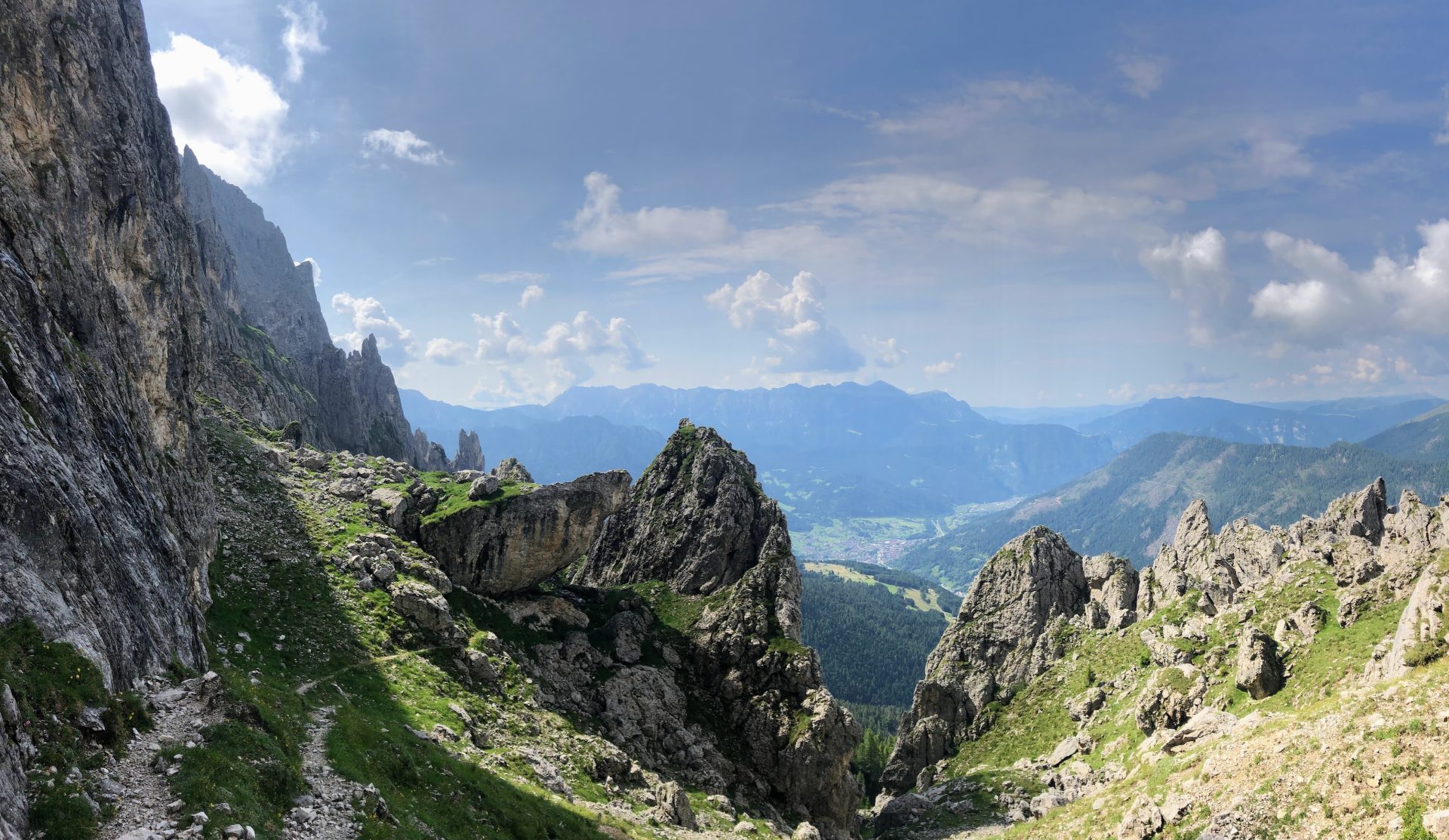
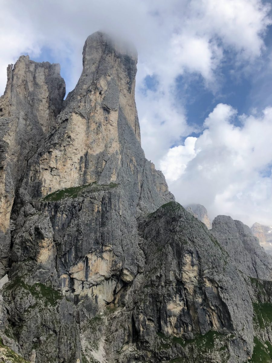
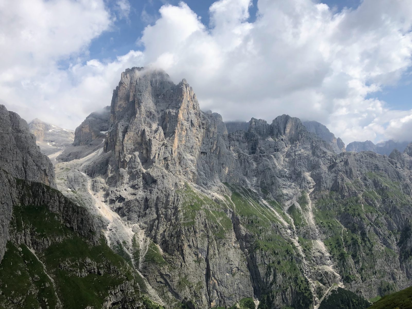
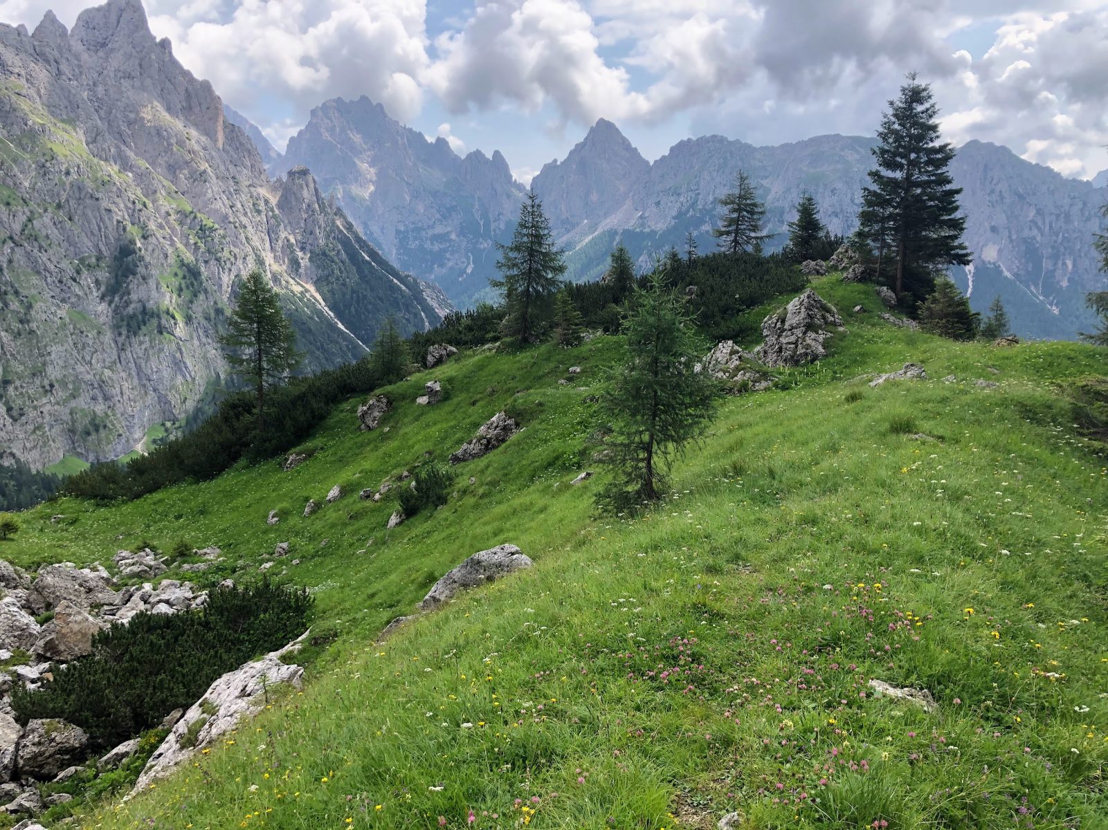
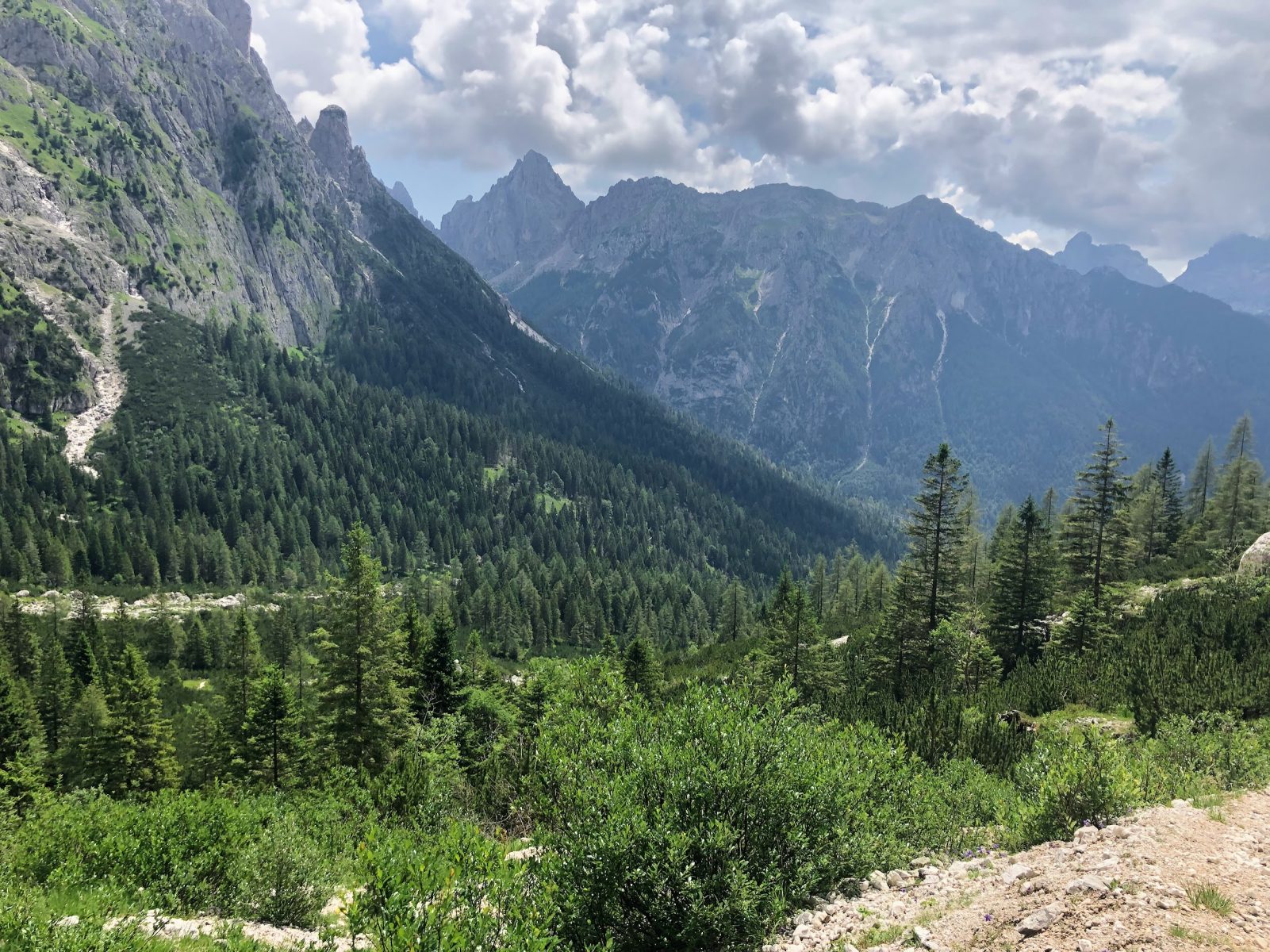
The Sentiero del Cacciatore path opens up a heartbreaking landscape over the Pradidali Valley, the Canali Valley and the peak named Cima Canali (2,859 m asl), as well as the one of Sass Maór on the W.
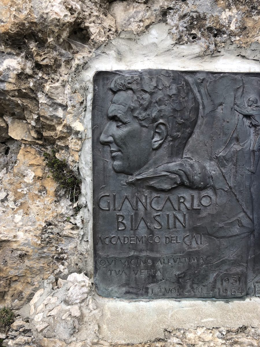
On the way to the end of the Sentiero del Cacciatore path, in memory of Giancarlo Biasin (who stumbled during the descent on the path in 1964), you will find a plaque dedicated to him.
Once reached the Pradidali Valley, at the crossroads with the Signpost No. 719, take the latter to the south towards Piereni / Fosne. From that point on, the Signpost No. 719 will gently descend, merging into a gravel road and taking you back to the starting point, in approximately 3.5 km.
This trek is a tribute to Samuele “Pape” Scalet (1940 ✝ 2010) and Giancarlo Biasin (1931 ✝ 1964), both academics of the CAI (tr. Italian Alpine Club) and great climbers. Scalet, missed on the 17 January 2010, for his latest book, considered by us to be one of the best about hiking in Primiero. Surely, he contributed a lot by sharing his passion for the mountains. Biasin, from Verona, for the memory of a great alpinist. On the 3rd of August 1964, after he opened together with Samuele Scalet one of the most difficult climbing routes of the Dolomites (Via Biasin on the Sass Maór peak), he met his tragic destiny by stumbling over a mountain pine just while he was descending to Val Pradidali along the Sentiero del Cacciatore path.
Paths
- From the pastures of Fósne (1,370 m asl), in Val Canali, take the Signpost No. 731 towards the mount called Col dei Cistri [0h 40],
- From the saddle of Forcella Col dei Cistri (1,568 m asl), keep going along the path called Sentiero Attrezzato Camillo Depaoli, marked as Signpost No. 734A, leading to Rifugio Velo della Madonna [3h 00],
- From the hut of Rifugio Velo della Madonna (2,358 m asl), keep climbing towards the peak of Stanga, following the marks indicating the path called Sentiero Attrezzato del Cacciatore / Ferrata Dino Buzzati, along the Signpost No. 742 [3h 45],
- From the southern saddle of Stanga, always on the Signpost No. 742, start descending along the path called Sentiero del Cacciatore [5h 20],
- Once getting to the crossroad with the Signpost No. 719, take the latter to the S towards Piereni / Fosne; keep following the Signpost No. 719, which is turning into a gravel road, for about 3.5 km, until getting back to the starting point [6h 00]. ✓
Waypoints
Best choices


Suggested hikes

- Demanding
Forks at Treviso
Canali Valley,Mis Valley,Pala Group
- Duration: 03:45 hrs
- Length: 6.2 km
- Elev. gain: 1400 m

- Demanding
Val de Stua
Lower Primiero,Vette Feltrine Range
- Duration: 05:30 hrs
- Length: 12.1 km
- Elev. gain: 1400 m


- Demanding
- Best choice
Leslie Stephen
Canali Valley,Pala Group,Upper Primiero
- Duration: 12:00 hrs
- Length: 29.5 km
- Elev. gain: 1400 m