By Andrew Gray
Scientists from the PIFSC Coral Reef Ecosystem (CRED) recently finished a 2-week live-aboard expedition to survey reef fish and benthic communities, collect water samples, and record data on seafloor depths along the northern coast of Timor-Leste. This mission was part of a larger operation that also included similar monitoring work based from land, capacity-building activities, and an outreach effort. Our last blog post from Timor-Leste left off with our boarding of the catamaran Sundancer NT on June 13 to start the live-aboard mission.
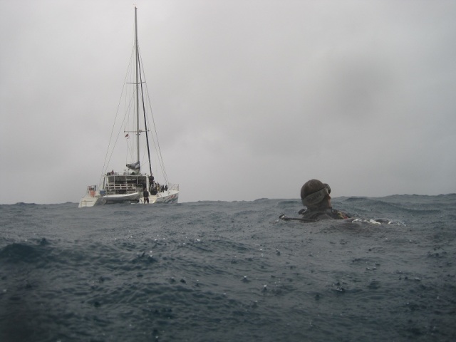
Brett Schumacher of the PIFSC Coral Reef Ecosystem Division surfaces behind the live-aboard vessel Sundancer NT on June 19 after conducting a survey of reef fishes and taking photos of benthic communities during a 2-week live-aboard mission off the northern coast of Timor-Leste. NOAA photo
We arrived at the Sundancer NT in Dili Harbor before lunch on June 13 after traveling in a pair of pickup trucks for 1.5 hours on narrow, winding roads from Caimeo Beach in Liquiçá, where we had ended our land-based survey work. Why switch to a boat-based mission? The beauty of a live-aboard situation is that it eliminates time spent on transfers between your base on land and survey sites. During our live-aboard mission, long distances between survey sites were covered at night as everyone slept and we arrived at our survey sites at first light. With the catamaran as our base, remote locations that could have been difficult or impossible to survey during a land-based setup—locations such as Oecussi, an enclave of Timor-Leste within Indonesia, and the dramatic, cliff-flanked jungle coast of the Lautem district—were as easy to access as Dili Harbor.
The first day of live-aboard operations began with a safety drill to assess our ability to rescue divers in distress. Max Sudnovsky of CRED and I put on our dive gear, and Sudnovsky feigned an unconscious diver ~90 m off the stern of the Sundancer NT. True to their training, the team had us both onboard and Sudnovsky stabilized and breathing oxygen within 5 min of starting the drill. We made a few tweaks to our setup—adding a pair of throw lines and staging the oxygen in the pilot house—to decrease our response time. With the drill done, we began our first operational dive of the mission, starting with collection of a water sample for analysis of dissolved inorganic carbon at one of the permanent monitoring sites set up in October by researchers during a previous CRED mission.
For the rest of that day and over the next 12 days, we leapfrogged down the coast to complete surveys with 2 dive teams—1 on the Sundancer NT and 1 on a tender boat—at sites in Oecussi, off Atuaro Island, and along the length of the northern coast of Timor-Leste from Bobonaro to the eastern tip of Jaco Island in the Lautem district. We completed our assessment activities at as many as 10 sites per day.
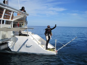
Kaylyn McCoy of the PIFSC Coral Reef Ecosystem Division gives the OK signal before she hops off the Sundancer NT and into the ocean on June 13 to conduct a stationary-point-count survey of reef fishes off the northern coast of Timor-Leste. NOAA photo
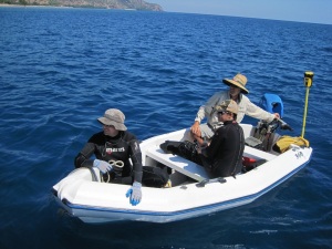
Aboard the tender boat piloted by Ian Brown, Brett Schumacher and Kaylyn McCoy of PIFSC return to the Sundancer NT after completing surveys and recording depth soundings off Timor-Leste on June 16. NOAA photo
The Sundancer NT, an aluminum catamaran (15.0 x 7.9 m) that was chartered through Compass Charters, served well during our mission. Two swim steps, one on the stern of each hull, were great entry and exit points for our dives. The vessel’s shallow draft and the expert driving of its captain, Peter Herdew, allowed us to get directly over any dive site. A tender boat served as a second dive platform, capable of holding 2 divers with scuba cylinders and the seafloor mapping tool. The mapping tool was used to opportunistically collect depth soundings to derive WorldView-2 satellite-derived depths and create accurate shallow-water bathymetry for the area, something Timor-Leste lacks at the moment. The tool consists of a transducer, processor, high-accuracy GPS unit, and a handheld computer that wirelessly receives and records data.
Regardless of the location of our first survey on a given day, by 7:30 a.m., when there was sufficient light for our visual surveys, we had already eaten breakfast, completed our safety brief and assembled our dive gear and the first team was ready to roll into the water. Typically, we wrapped up surveys by 5 p.m., leaving time to rinse and put away gear and enter the day’s data before a dinner at 8 p.m. After dinner, the team took turns reading off data entered into the database to assure quality and then headed to our bunks for the night as the Sundancer NT transited to the next survey site.
As Paula Ayotte, Kevin Lino, Kaylyn McCoy, Brett Schumacher, and I conducted surveys and collected water samples from the Sundancer NT, Sudnovsky, who was the project coordinator for this mission, and Rui Pinto, who was an invaluable local contact and master logistician from the Coral Triangle Support Partnership (CTSP), followed us by land along the northern coast. Sudnovsky and Pinto visited each district prior to our arrival by sea to inform the communities about our presence in the area, the data we were collecting, and how that data can benefit them and the country of Timor-Leste. They also did an outstanding job of working with local fisheries officers, fishermen, and NGOs to raise community awareness of ocean acidification and today’s changing ocean as well as awareness of the need for local management of Timor-Leste’s nearshore reef fisheries and simple steps that can be taken to help protect local fisheries. Intermittently, Sudnovsky provided help aboard the Sundancer NT, in addition to his participation in the safety drill on the first day of the live-aboard mission. Pinto and Sudnovsky provided a banner (1 x 3 m) for the catamaran that read, “Levantamentu dadu kona-ba biomasa ikan iha Timor-Leste nia tasi-feto,” and included the insignia of all cooperating agencies: NOAA, U.S. Agency for International Development, Conservation International, CTSP, and the Democratic Republic of Timor-Leste. This banner text translates to “Fish biomass surveys in Timor-Leste’s female sea.” The female sea is the sea to the north of the country, and the male sea is to the south.
Besides the out-of-season squalls and high winds (and subsequent wind swell) that we encountered on the second half of this mission, our biggest challenge was finding locations with the proper substrate and visibility to conduct surveys. The stationary-point-count survey method requires only reasonable visibility (~8 m) and a hard bottom at survey depths. In some areas of the Manatutu district, a number of rivers create silty bottoms and zero visibility, and we had to transit long distances between surveys.
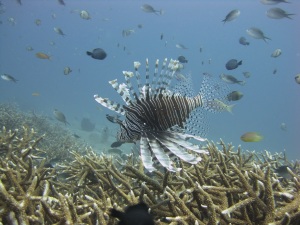
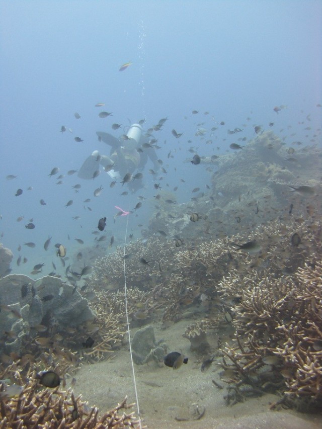
A red lionfish (Pterois volitans) hovers motionless above corals of the genus Acropora on a reef off the northern coast of Timor-Leste on June 16. NOAA photo
Despite such challenges, during the live-aboard mission on June 13–27, our team completed 92 surveys throughout the 7 northern districts of Timor-Leste, reaching our goal of surveys conducted at 150 sites over our entire operation at Timor-Leste last month. We identified 456 species of fishes from 52 families during our surveys. Observed species included the humphead wrasse (Cheilinus undulatus), which is nationally protected in Timor-Leste and listed as endangered on the IUCN Red List of Threatened Species, and bumphead parrotfish (Bolbometopon muricatum), which is listed as vulnerable on the IUCN Red List of Threatened Species. We even had 2 underwater encounters with the elusive dugong (Dugong dugon), a large mammal that is in the same order as manatees. Although we have yet to analyze the data we collected, our general impression was that, in addition to the high diversity of the areas that we surveyed, there was a general abundance of small- to medium-bodied food fishes on reefs at the depths surveyed (≤18 m) with occasional larger individuals.
We thank Captain Herdew and the Sundancer NT crew (Ian Brown, Kym Miller, and Kim Hamilton) for helping us achieve our goal of 150 sites surveyed. This expedition to collect baseline data on reef fishes and benthos for the government of Timor-Leste and NOAA has been a rewarding experience, and we are all looking forward to the results of our analyses of these survey data. Check in again at this space to hear from team lead Kevin Lino, who will provide a mission summary.



Pingback: Update from Timor-Leste: scientists complete li...
Pingback: The final count: summary of mission to assess reef fish assemblages, build capacity in Timor-Leste | NOAA Pacific Islands Fisheries Science Center Blog