|
search place name
|
||
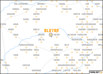
Aleyar (Gongola, Nigeria)Aleyar is a town in the Gongola region of Nigeria. An overview map of the region around Aleyar is displayed below.
regional and 3d topo map of Aleyar, Nigeria ::
Aleyar airports ::
The nearest airport is YOL - Yola, located 141.8 km south of Aleyar.
Other airports nearby include MIU - Maiduguri (193.7 km north east), GOU - Garoua (195.5 km south east), Nearby towns ::
Dayar (1.8km east) //
Shakda (2.6km north east) //
Sabongari (2.6km north east) //
Jakari (3.6km west) //
Kurdun (3.7km south) //
Zaltu (4.1km south west) //
Kogu (4.1km south east) //
Bibarkui (4.1km south east) //
Gwori (4.1km south east) //
Pika (4.1km south east) //
Mbula (5.8km west) //
Maina Pidugu (5.9km south) //
Chani (5.9km south) //
Hyama (6.6km south west) //
Bila (6.6km south east) //
Bilahima (7.3km east) //
Shafa (7.6km south) //
Bakin Kasuwa (7.6km south) //
Kogu (7.8km south west) //
Magaba (7.8km north west) //
Safra (9.2km north west) //
Mindi (9.2km south east) //
Whada (9.2km south west) //
Gwadzam (9.2km south east) //
Gundu (10.4km south east) //
[all distances 'as the bird flies' and approximate] 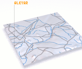 Places with similar names to Aleyar, Nigeria ::
Disclaimer :: Information on this page comes without warranty of any kind |
||
|
Where is Aleyar? Elevation and coordinates ::
Latitude (lat): 10°28'0"N Longitude (lon): 12°0'0"E
Elevation (approx.): 440m (map arrows pan, magnifying glasses zoom) |
||
|
Visiting Aleyar? Hotel/Accommodation ::
Book a hotel in Aleyar Travel Guide ::
Buy a travel guide for Nigeria rental cars ::
car rental offers GPS waypoint ::
download a GPX waypoint (PoI) of Aleyar for your GPS receiver
|
||