|
search place name
|
||
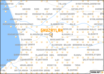
Ghuzaylah (Liban-Nord, Lebanon)Ghuzaylah is a town in the Liban-Nord region of Lebanon. An overview map of the region around Ghuzaylah is displayed below.
regional and 3d topo map of Ghuzaylah, Lebanon ::
Ghuzaylah airports ::
The nearest airport is LTK - Latakia Bassel Al Assad Intl, located 89.9 km north of Ghuzaylah.
Other airports nearby include BEY - Beirut Rafic Hariri Intl (103.2 km south west), DAM - Damascus Intl (137.4 km south), RPN - Rosh Pina Mahanaim I Ben Yaakov (186.1 km south), ALP - Aleppo Intl (202.9 km north east), Nearby towns ::
Dārīn (0.0km north) //
Sa‘dīn (1.5km west) //
Nab‘ al Ghuzaylah (1.9km south) //
Ḩawshab (1.9km south) //
Tall Kindī aş Şaghiīr (1.5km west) //
Ar Rayḩānīyah (2.4km south east) //
Kuwaykhāt (2.4km south west) //
Shīr Ḩumayrīn (2.4km north east) //
Şaydnāyā (2.4km south east) //
Tall ‘Abbās ash Sharqī (2.4km south west) //
Tallat al Mujabbir (2.4km south west) //
Haytlah (3.1km east) //
Mzayḩimah (3.1km east) //
Ḩukr Jūrat Srār (3.7km north) //
Ash Shaykh ‘Ayyāsh (3.7km north) //
Al ‘Azīzīyah (3.7km north) //
Al Ja‘r (3.7km south) //
Bayt al Ḩājj (3.7km south) //
Kūshā (3.7km south) //
Ḩukr Jānīn (4.0km north) //
Ma‘rubū (4.0km north) //
Tall Ḩumayrah (4.0km north) //
Al Mushayrifah (4.0km north) //
Srār (3.6km north east) //
Al ‘Abbūdīyah (4.0km north) //
Al Kanīsah (4.0km south) //
Tallat az Zafīr (4.0km south) //
Tall ‘Abbās al Gharbī (3.6km south west) //
Maţḩanat al Ju‘aydīyah (4.0km south) //
[all distances 'as the bird flies' and approximate]  Places with similar names to Ghuzaylah, Lebanon ::
Disclaimer :: Information on this page comes without warranty of any kind |
||
|
Where is Ghuzaylah? Elevation and coordinates ::
Latitude (lat): 34°36'0"N Longitude (lon): 36°6'0"E
Elevation (approx.): 52m (map arrows pan, magnifying glasses zoom) |
||
|
Visiting Ghuzaylah? Hotel/Accommodation ::
Book a hotel in Ghuzaylah Travel Guide ::
Buy a travel guide for Lebanon rental cars ::
car rental offers GPS waypoint ::
download a GPX waypoint (PoI) of Ghuzaylah for your GPS receiver
|
||