
Some of the Midwest’s most scenic vistas are the black volcanic cliffs that tower above the brilliant blue waters of Lake Superior’s north shore. How these formed more than a billion years ago is an amazing story, illustrating one of plate tectonics’ most important processes—how continents form and break up.
Over geologic time, continents collide and fuse together. They also split apart, along rifts.
Rifts are linear features along which continents stretch. When a rift succeeds, the continent splits, and a new ocean basin forms between the two parts of the continent. Some rifts, however, fail to develop into seafloor spreading centers and instead leave major relict structures within continents—“fossils” preserving the geologic environments in which they formed.
The cliffs on the shores of Lake Superior—and the lake itself—are part of such a fossilized rift. Called the Midcontinent Rift (MCR), this 3000-kilometer-long feature, made of 1.1-billion-year-old igneous and sedimentary rocks, extends underground across the central United States. It stands as one of the best examples of a failed rift (Figure 1).
However, a puzzle remains. The MCR’s igneous rocks tell of magma pools far more vast than what one would expect in a failed rift. Why was the MCR so magma rich? Scientists are beginning to tease out answers.
Formation at a Plate Boundary
The traditional view of the formation and evolution of the MCR involved two premises. First, the MCR formed within Laurentia, the core of North America that assembled in the Precambrian era. Second, the MCR failed to split the continent because compression from a mountain-building episode ended the extension and volcanism. This mountain building, called the Grenville orogeny, finished about 980 million years ago and was associated with the assembly of Laurentia and other continental blocks into the supercontinent of Rodinia.
The MCR’s igneous rocks tell of magma pools far more vast than what one would expect in a failed rift.
However, a new view of the MCR emerges from studies catalyzed by the National Science Foundation’s EarthScope program. One of this program’s goals is “to integrate geological and geophysical data to understand the growth and modification of North America over billion-year time scales.”
The new view begins from reanalysis of gravity data, which show that the MCR extends farther south than previously thought. The east arm (Figure 1) had been assumed to end in Michigan at the Grenville Front, the westernmost deformation associated with the Grenville orogeny. However, this arm now appears to extend along the previously enigmatic East Continent Gravity High, which now seems to be part of the MCR. The arm stops at what scientists believe to be a fossil continental margin, where the Amazonia craton (Precambrian rock now found in northeastern South America) rifted from Laurentia (Figure 1b).
![Fig. 1. (a) Gravity map showing the Midcontinent Rift (MCR). The west arm extends southward from Lake Superior at least to Oklahoma along the Southern Oklahoma Aulacogen (SOA). The east arm goes through Michigan and extends along the Fort Wayne rift (FWR) and East Continent Gravity High (ECGH) to Alabama [C. A. Stein et al., 2015]. The Grenville Front is shown by a solid line where observed and by a dashed lined where inferred. “S” shows location of seismic line across Lake Superior in Figure 2a. Box shows approximate area of the Superior Province Rifting Earthscope Experiment (SPREE) seismic experiment. (b) Schematic illustration of MCR forming as part of the rifting of Amazonia from Laurentia. (c) Africa rifting into major plates and microplates [Stein et al., 2014].](https://i0.wp.com/eos.org/wp-content/uploads/2016/08/fig-1-gravity-map-showing-midcontinent-rift.png?resize=780%2C541&ssl=1)
Hence, the MCR probably formed during this rifting and failed once seafloor spreading between the major plates was established [Stein et al., 2014]. In this view, the MCR’s arms were boundaries of a microplate within a plate boundary zone [Merino et al., 2013], similar to the arms of today’s East African Rift, where microplates exist in the zone where Africa is splitting into two major plates (Figure 1c). Once seafloor spreading between the major plates is fully established in the East African Rift, some of the microplate boundaries should stop spreading and remain within the continents as failed rifts.
In this view, the MCR’s arms were boundaries of a microplate within a plate boundary zone.
The MCR formed in a similar way, as Laurentia and Amazonia split apart.
Paleomagnetic studies show that Laurentia’s motion changed dramatically when the MCR formed—as volcanic rocks cooled, magnetic minerals aligned with Earth’s magnetic field, recording changes in the plate’s motion. Such changes are often found in the paleomagnetic record when continents rifted apart. As part of the rifting, the MCR formed and began extending. The region between the MCR’s two spreading arms was forced to move away from the rest of Laurentia as a microplate.
A Hybrid Rift
Dense volcanic material fills the MCR. This large, concentrated mass exerts a greater gravitational pull than the areas around it—resulting in what’s known as a positive gravity anomaly. In contrast, typical continental rifts have negative anomalies because they are filled primarily with low-density sedimentary rock.
Tracing the gravity anomaly shows that the MCR’s arms have characteristic geometries of rifts—linear depressions that formed as plates pulled apart and that filled with sedimentary and igneous rocks. These depressions often evolve into plate boundaries.
The MCR is also a large igneous province, a region of extensive volcanism associated with upwelling and melting of deep mantle materials.
Calculating the volume of volcanic rock causing this positive gravity anomaly reveals something interesting about the MCR. It is also a large igneous province (LIP), a region of extensive volcanism associated with upwelling and melting of deep mantle materials. MCR volcanics are significantly thicker than those at other LIPs because magma was deposited within a narrow rift rather than across a broad surface. Hence, the MCR is a hybrid with the geometry of a rift but the igneous rock volume of a LIP [C. A. Stein et al., 2015].
How Did This Hybrid Evolve?
Reflection seismic data (Figure 2a) across Lake Superior [Green et al., 1989] show how this unusual combination evolved. The MCR is a basin between dipping faults that contains volcanic rocks up to 20 kilometers thick, overlain by about 5–8 kilometers of sedimentary rocks. The lower volcanic layers truncate toward the basin’s north side, indicating that they were deposited while the rift was extending by motion on the northern fault. The upper volcanic layers and overlying sedimentary rocks dip from both sides and thicken toward the basin center, indicating that they were deposited after extension ended, as the basin continued to subside. Radiometric dating shows that the volcanic rocks are about 1.1 billion years old.
Another seismic line to the east shows a similar sequence, but with extension on the southern fault. Basins produced by extension on only one side are called half grabens (Figure 2a), so the MCR is a sequence of alternating half grabens, similar to what’s found today along the arms of the East African Rift.

Working backward from the geometry of the volcanic and sedimentary rock layers seen today provides an evolutionary model of the feature (Figure 2b). The MCR began as a half graben filled by flood basalts. After rifting (extension) stopped, the basin further subsided, accommodating more flood basalts. After volcanism ended, subsidence continued, accompanied by sedimentation. The crust depressed and flexed under the load of the basalt and sedimentary rocks.
Long after subsidence ended, the area was compressed—a process called basin inversion—which reversed motion on the faults and activated new ones. The original crust thinned during rifting as the crust stretched, rethickened during the postrift phase because of the added volcanics and sediments, and thickened further because of the compression when the basin inverted. If the model is correct, then crustal thickness along the MCR should vary with the amounts of extension and volcanism and the amount and direction of compression applied to that portion of the MCR.
Surprises from Seismic Imaging
New insights on MCR come from data from Earthscope seismometers in the transportable array that “rolled” across the United States, the Superior Province Rifting Earthscope Experiment (SPREE) flexible array [Stein et al., 2011; Wolin et al., 2015], and Canadian seismic stations.
Seismic models covering much of the rift are being developed with these data [Shen et al., 2013; Bollmann et al., 2014; Al-Eqabi et al., 2015; Zhang et al., 2015; Fredriksen et al., 2015]. As expected from the Lake Superior data, crust in the MCR’s west arm is thicker than its surroundings (Figures 3a and 3b) and is composed of sedimentary rocks underlain by layered volcanic rocks. Combining the results with gravity and seismic reflection data gives views of the MCR’s crustal thickness and structure that will better constrain models of its evolution [e.g., Levandowski et al., 2015].

These studies have already yielded surprising results. The MCR’s dense volcanic rocks appear clearly on gravity, seismic reflection, and receiver function data, which are sensitive to variations in density. However, surface wave tomography (Figures 3c and 3d) “sees” the rift’s sedimentary rocks through which seismic waves travel slowly but does not see high velocity in the rift-filling volcanics. The basalt rift fill is presumably denser than the surrounding crust, but the velocities of shear waves traveling through it are similar or slightly lower than those of the surrounding rocks.
Another surprise is that the formation of the MCR left little signature in the upper mantle. Although vast quantities of melt were extracted to fill the MCR, the mantle shows no significant seismic velocity anomalies [Shen et al., 2013; Bollmann et al., 2014]. Unless the mantle beneath the MCR was replaced after the MCR formed, melt depletion seems to have had little effect on seismic velocities. The idea that extracting melt from the mantle would not change the mantle’s seismic velocity significantly is surprising but consistent with a model for melt extraction by Schutt and Lesher [2006].
Moreover, mantle flows or oriented magma bodies usually make seismic wave speeds vary depending on the direction the waves travel, so waves tend to go faster along currently extending rifts than across them. However, Ola et al. [2016] find no such anisotropy below the MCR, perhaps because much of the volcanism occurred after extension ended.
Current and future studies combining petrology, geochemistry, geochronology, paleomagnetism, plate motions, and magnetotellurics will continue to explore what these surprises mean for the evolution of the rift.
Did a Hot Spot Supply the Excess Magma?
The MCR is an extraordinary feature that arose from an unusual combination of a continental rift and a LIP, illustrating that over a billion years of Earth history, even unlikely events can happen. Rifting can be classified into two types: “passive” rifting in which forces pull the lithosphere in opposite directions, extending it [Sengor and Burke, 1978], and “active” rifting, where a mantle plume or hot spot thermally uplifts and stretches the crust above it [e.g., Nicholson et al., 1997]. For the MCR, we suspect that the rifting continent by chance overrode a plume or a region of anomalously hot upper mantle, so both active and passive rifting may have been at play.
Modeling implies that the MCR’s magma volume cannot have been generated by passive upwelling beneath an extending rift.
Initial modeling [Moucha et al., 2013] implies that the MCR’s magma volume cannot have been generated by passive upwelling beneath an extending rift, even though the Precambrian mantle was hotter than today’s. Bowles-Martinez and Schultz [2015] find a highly conductive anomaly below western Lake Superior and northwestern Wisconsin, extending to depths below 200 kilometers, that may have been formed by a mantle plume and somehow persisted. A question currently being discussed involves how the magma source operated over a long period of rapid plate motion [Swanson-Hysell et al., 2014].
MCR Failure
The MCR was previously thought to have failed—stopped extending—because of regional compression associated with the Grenville orogeny [Cannon, 1994]. However, new age dating shows that most of the compression recorded by reverse faulting occurred long after extension and volcanism ended. Thus, MCR’s failure was not due to Grenville compression [Malone et al., 2016]. Instead, it stopped spreading much earlier, once seafloor spreading between Amazonia and Laurentia was fully established.
Insights into Other Rifts and Continental Margins
The MCR results help place other rifts worldwide in their evolutionary sequence via “comparative riftology”—comparing rifts at different stages in their evolution. Today’s East African rift looks like what we envision for the MCR during rifting—a gravity low, low velocities due to the high temperatures, and thin crust below the extending arms. The Southern Oklahoma Aulacogen, a failed rift that opened in the Cambrian breakup of Rodinia and was inverted in the late Paleozoic, appears similar to today’s MCR, with a gravity high due to the igneous rocks filling the rift.
The MCR shows what a passive margin looked like in its early stages.
By analogy, failed rifts similar to the MCR will have thick crust even if they have not been inverted, and inverted ones will have the thickest crust. Similarly, the gravity anomaly should change from a low to become progressively more positive as the rift fails and is later inverted.
The MCR has many features similar to those observed at volcanic passive continental margins. Volcanic margins arise where continental rifting is associated with large-scale melting that gives rise to thick igneous crust. Hence, the MCR shows what a passive margin looked like in its early stages.
MCR’s Legacy Showcases Geology’s Effect on Culture
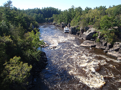
The MCR highlights geoheritage: geology’s role in an area’s culture and growth [S. Stein et al., 2015]. Lake Superior and the surrounding spectacular scenery in national, state, and provincial parks are underlain by the MCR. The lake lies above the rift because soft sedimentary rocks within the MCR were easier for ice age glaciers to erode than the volcanic rocks. Thus, the rift provided the region’s first transportation system—Native Americans and Europeans used the lake to import and export trade goods. The lake remains an economic engine and tourist attraction.
Also, the MCR’s mineral deposits shaped the region’s settlement and growth. Water flowing through the volcanic rocks dissolved copper and deposited it in concentrations that became sources of valuable ore in many places around Lake Superior. For at least the past 7000 years, Native Americans have mined copper and traded it as far south as Illinois. The discovery of commercially viable copper deposits during the 1840s led to a mining boom that shaped the area’s economy.
Watch this video for more on MCR’s geologic and cultural history.

More information for the public, park interpreters, informal educators, and teachers can be found on websites hosted by Michigan Technological University and Northwestern University.
The MCR is a place where visitors can interact with geological features more than 1 billion years old. Its evolution—from extensional beginnings to rift failure, from ice age glaciers scouring it to lake infill, from ancient copper miners to modern boaters enjoying a lazy summer day—shows how geology weaves the fabric not only of our continents but also of our lives.
Acknowledgments
This work was supported by National Science Foundation grants EAR-1148088 and EAR-0952345 and by the Alexander von Humboldt Foundation.
References
Al-Eqabi, G., et al. (2015), Rayleigh wave tomography of Mid-Continent Rift, Abstract T11C-2904 presented at 2015 Fall Meeting, AGU, San Francisco, Calif., 14–18 Dec.
Bollmann, T., S. van der Lee, A. W. Frederiksen, E. Wolin, G. I. Aleqabi, J. Revenaugh, D. A. Wiens, and F. A. Darbyshire (2014), Teleseismic P-wave tomography of the Superior Province and Midcontinent Rift region, Abstract S13B-4455 presented at 2014 Fall Meeting, AGU, San Francisco, Calif., 15–19 Dec.
Bowles-Martinez, E., and A. Schultz (2015), Midcontinent Rift and remnants of initiating mantle plume imaged with magnetotellurics, Abstract T11D-2922 presented at 2015 Fall Meeting, AGU, San Francisco, Calif., 14–18 Dec.
Cannon, W. F. (1994), Closing of the Midcontinent Rift—A far-field effect of Grenvillian compression, Geology, 22, 155–158.
Frederiksen, A., et al. (2015), Crustal properties across the Mid-Continent Rift via transfer function analysis, Abstract T11C-2905 presented at 2015 Fall Meeting, AGU, San Francisco, Calif., 14–18 Dec.
Green, A. G., W. F. Cannon, B. Milkereit, D. R. Hutchinson, A. Davidson, J. C. Behrendt, C. Spencer, M. W. Lee, P. Morel-á-LáHuissier, and W. F. Agena (1989), “GLIMPCE” of the deep crust beneath the Great Lakes, in Properties and Processes of Earth’s Lower Crust, Geophys. Monogr. Ser., vol. 51, edited by R. F. Mereu, S. Mueller, and D. M. Fountain, pp. 65–80, AGU, Washington, D. C.
Levandowski, W., O. S. Boyd, R. W. Briggs, and R. D. Gold (2015), A random‐walk algorithm for modeling lithospheric density and the role of body forces in the evolution of the Midcontinent Rift, Geochem. Geophys. Geosyst., 16, 4084–4107, doi:10.1002/2015GC005961.
Malone, D. H., C. A. Stein, J. P. Craddock, J. Kley, S. Stein, and J. E. Malone (2016), Maximum depositional age of the Neoproterozoic Jacobsville Sandstone, Michigan: Implications for the evolution of the Midcontinent Rift, Geosphere, doi:10.1130/GES01302.1.
Merino, M., G. R. Keller, S. Stein, and C. Stein (2013), Variations in Mid-Continent Rift magma volumes consistent with microplate evolution, Geophys. Res. Lett., 40, 1513–1516.
Moidaki, M., S. S. Gao, K. H. Liu, and E. Atekwana (2013), Crustal thickness and Moho sharpness beneath the Midcontinent Rift, Res. Geophys., 3, e1.
Moucha, R., et al. (2013), Geodynamic modeling of the Mid-Continental Rift System: Is a mantle plume required?, Abstract T21B-2545 presented at 2013 Fall Meeting, AGU, San Francisco, Calif., 9–13 Dec.
Nicholson, S. W., S. B. Shirey, K. J. Schulz, and J. C. Green (1997), Rift-wide correlation of 1.1 Ga Midcontinent Rift system basalts: Implications for multiple mantle sources during rift development, Can. J. Earth Sci., 34, 504–520.
Ola, O., A. W. Frederiksen, T. Bollmann, S. van der Lee, F. Darbyshire, E. Wolin, J. Revenaugh, C. Stein, S. Stein, and M. Wysession (2016), Anisotropic zonation in the lithosphere of central North America: Influence of a strong cratonic lithosphere on the Mid-Continent Rift, Tectonophysics, in press.
Schutt, D. L., and C. E. Lesher (2006), Effects of melt depletion on the density and seismic velocity of garnet and spinel lherzolite, J. Geophys. Res., 111, B05401, doi:10.1029/2003JB002950.
Sengor, A. M. C., and K. Burke (1978), Relative timing of rifting and volcanism and its tectonic implications, Geophys. Res. Lett., 5, 419–421.
Shen, W., M. H. Ritzwoller, and V. Schulte-Pelkum (2013), Crustal and uppermost mantle structure in the central U.S. encompassing the Midcontinent Rift, J. Geophys. Res., 118, 4325–4344.
Stein, C. A., S. Stein, M. Merino, G. Randy Keller, L. M. Flesch, and D. M. Jurdy (2014), Was the Midcontinent Rift part of a successful seafloor-spreading episode?, Geophys. Res. Lett., 41, 1465–1470, doi:10.1002/2013GL059176.
Stein, C. A., J. Kley, S. Stein, D. Hindle, and G. R. Keller (2015), North America’s Midcontinent Rift: When rift met LIP, Geosphere, 11, 1607–1616.
Stein, S., et al. (2011), Learning from failure: The SPREE Mid-Continent Rift Experiment, GSA Today, 21, 5–7.
Stein, S., C. A. Stein, E. Blavascunas, and J. Kley (2015), Using Lake Superior parks to explain the Midcontinent Rift, Park Sci., 32, 19–29.
Swanson-Hysell, N. L., S. D. Burgess, A. C. Maloof, and S. A. Bowring (2014), Magmatic activity and plate motion during the latent stage of Midcontinent Rift development, Geology, 42, 475–478.
Wolin, E., S. van der Lee, T. A. Bollmann, D. A. Wiens, J. Revenaugh, F. A. Darbyshire, A. W. Frederiksen, S. Stein, and M. E. Wysession (2015), Seasonal and diurnal variations in long-period noise at SPREE stations, Bull. Seismol. Soc. Am, 105, 2433–2452.
Zhang, H., et al. (2015), Crustal structure of and near the Mid-Continent Rift System from receiver function studies, Abstract S13B-4454 presented at 2015 Fall Meeting, AGU, San Francisco, Calif., 14–18 Dec.
Author Information
Seth Stein (seth@earth.northwestern.edu), Northwestern University, Evanston, Ill.; Carol Stein, University of Illinois at Chicago, Chicago; Jonas Kley, Georg-August-Universität Göttingen, Göttingen, Germany; Randy Keller, University of Oklahoma, Norman; Miguel Merino, Chevron Corporation, Houston, Texas; Emily Wolin, Northwestern University, Evanston, Ill.; Douglas Wiens, Michael E. Wysession, Ghassan Al-Equabi, and Weisen Shen, Washington University, St. Louis, Mo.; Andrew Frederiksen, University of Manitoba, Winnipeg, MB, Canada; Fiona Darbyshire, Université du Québec à Montréal, Montreal, QC, Canada; Donna Jurdy, Northwestern University, Evanston, Ill.; Greg Waite, William Rose, and Erika Vye, Michigan Technological University, Houghton; Tyrone Rooney, Michigan State University, East Lansing; Robert Moucha, Syracuse University, Syracuse, N.Y.; and Eric Brown, Aarhus University, Aarhus, Denmark
Citation:
Stein, S.,Stein, C.,Kley, J.,Keller, R.,Merino, M.,Wolin, E.,Wiens, D.,Wysession, M. E.,Al-Equabi, G.,Shen, W.,Frederiksen, A.,Darbyshire, F.,Jurdy, D.,Waite, G.,Rose, W.,Vye, E.,Rooney, T.,Moucha, R., and Brown, E. (2016), New insights into North America’s Midcontinent Rift, Eos, 97, https://doi.org/10.1029/2016EO056659. Published on 04 August 2016.
Text © 2016. The authors. CC BY-NC-ND 3.0
Except where otherwise noted, images are subject to copyright. Any reuse without express permission from the copyright owner is prohibited.